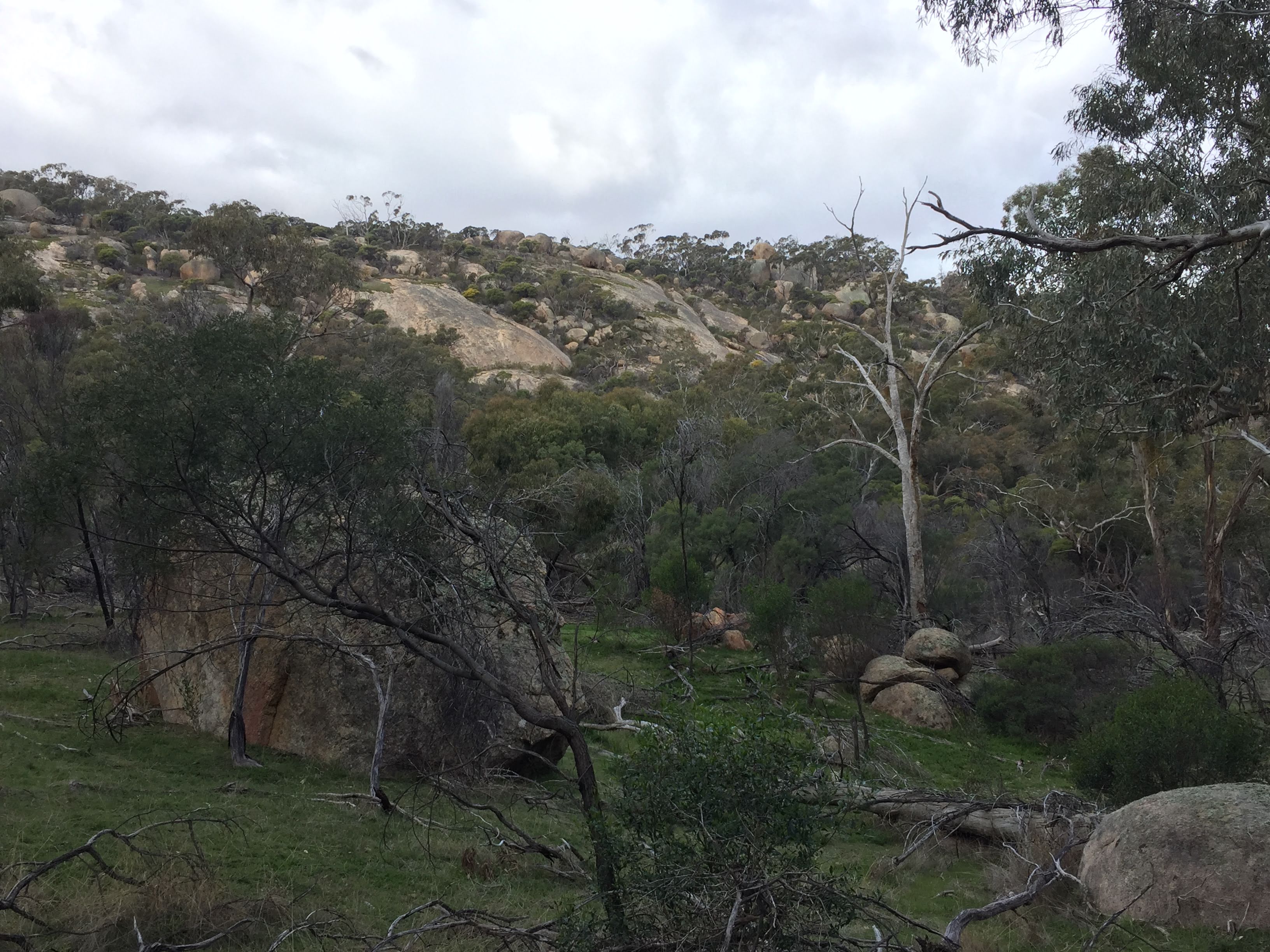
The Kooyoora State Park is located approximately 220 km north-west of Melbourne between Wedderburn and Rheola (Figure 1). The park owes its popularity to the Melville Caves, a rocky outcrop which provides a huge variety of recreational opportunities including bushwalking, rock climbing, camping and picnicking.
Rocky outcrops across Victoria play an important role in early colonial history, often used by bushranges as hideouts in the mid-late 19th Century. The Melville Caves were named in reference to Frank McCallum (a.k.a. Captain Melville), who committed robberies between Melbourne and Ballarat. When you climb to the top of the granite outcrop you will know why – there are 360 degree views stretching far into the distance.
The geology of the region surrounding the Kooyoora State Park (Figure 2) is dominated by big round blobs – granites (coloured brown in map below). Granites were all once red-hot liquid magma that rose from deep in the Earth, intruding pre-existing layers of rocks (coloured purple and green in the map below) by forcing open cracks and settling in a buried magma chamber. They only get exposed at the surface through millions of years of erosion (wind and water dispersing overlying sediments).
For obvious reasons geologists can’t actually see this happening. We’d have to dig a hole 15 km deep straight into the Earth and somehow work out how not to melt in temperatures of 650 Degrees Celcius! No, instead we have to observe granites when they are exposed at surface: what kind of minerals they contain, how old they are and how much they cooked the surrounding rock. Melville Caves at the Kooyoora State Park is an excellent place to make these sorts of observations!
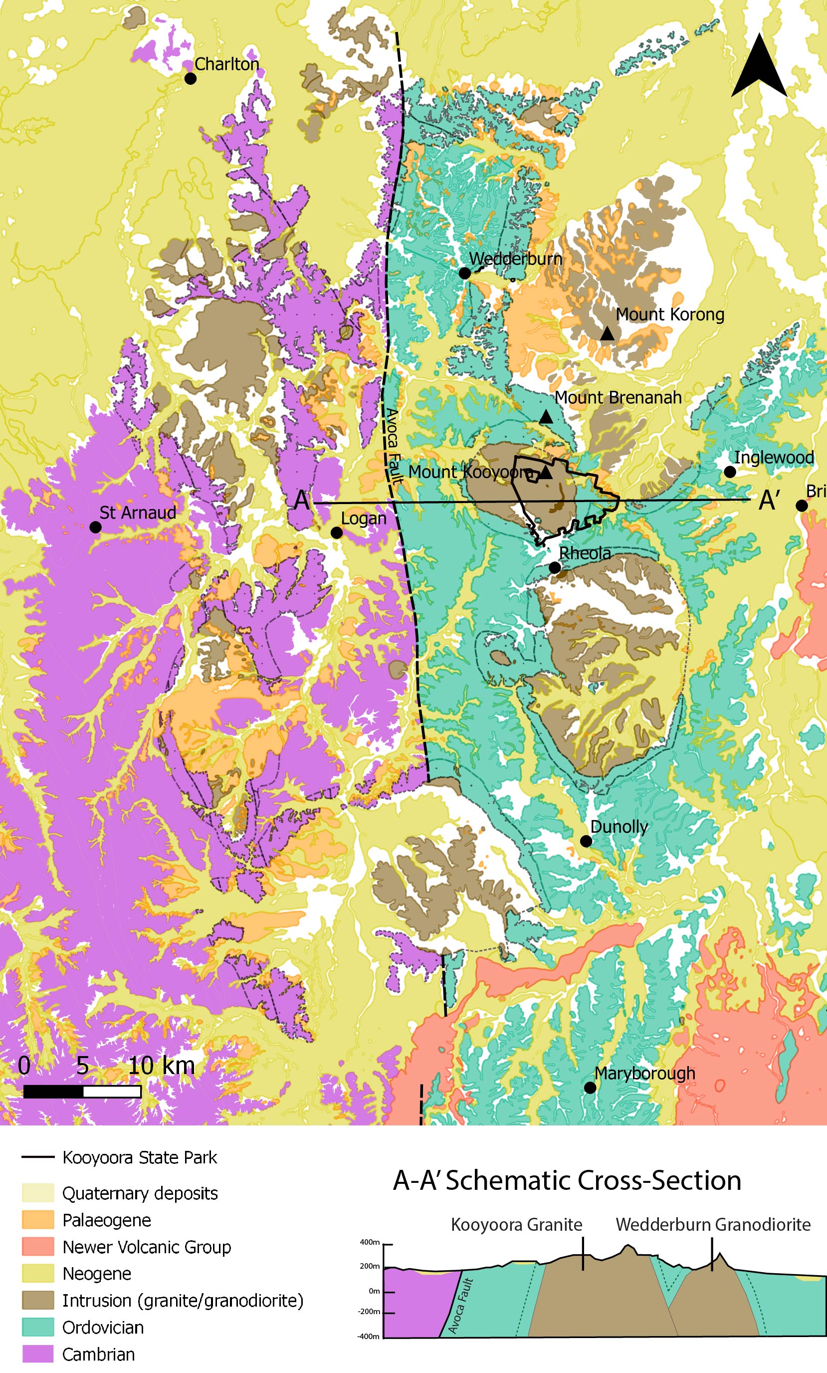
The basement rocks were being deposited for millions of years before the granites arrived. The map above (Figure 2) is divided straight down the middle by a large fault called the Avoca Fault. Faults are deep fractures in the earth’s crust, often where earthquakes occur. On the western side of the fault are older Cambrian St Arnaud Group rocks (coloured purple) and one the eastern side of the fault are younger Ordovician Castlemaine Supergroup rocks (coloured aqua). The units are nearly identical: sandstone-dominant deep-water marine turbidite facies. The major difference is the presence of fossils in the Ordovician units (Graptolites) and not in the Cambrian units. The schematic cross-section shows the relationship between these rock units (Figure 2).
There are a number of granite intrusions smeared across the region, varying in size from 1km to 20km, with over 20 individual bodies in just the map above. All of the granites are dated to the Early Devonian, with the ages ranging from 411 to 386 million years old. The granites have names like: Moliagul Granodiorite, Woosang Granite, Teddywaddy Granite, Aughaderry Tonalite and Mt Egbert Granite. Whilst the first part of the name may be funny or unusual, it is the second part of the name which tells us something about what that granite might look like. So what’s in a granite?
Geologists classify intrusive rocks based on the percentages of three minerals: Quartz, Alkali Feldspar (Potassium-rich, K) and Plagioclase Feldspar (Sodium, Na, and Calcium, Ca-rich). This is graphically represented in a QAP diagram (Figure 4).
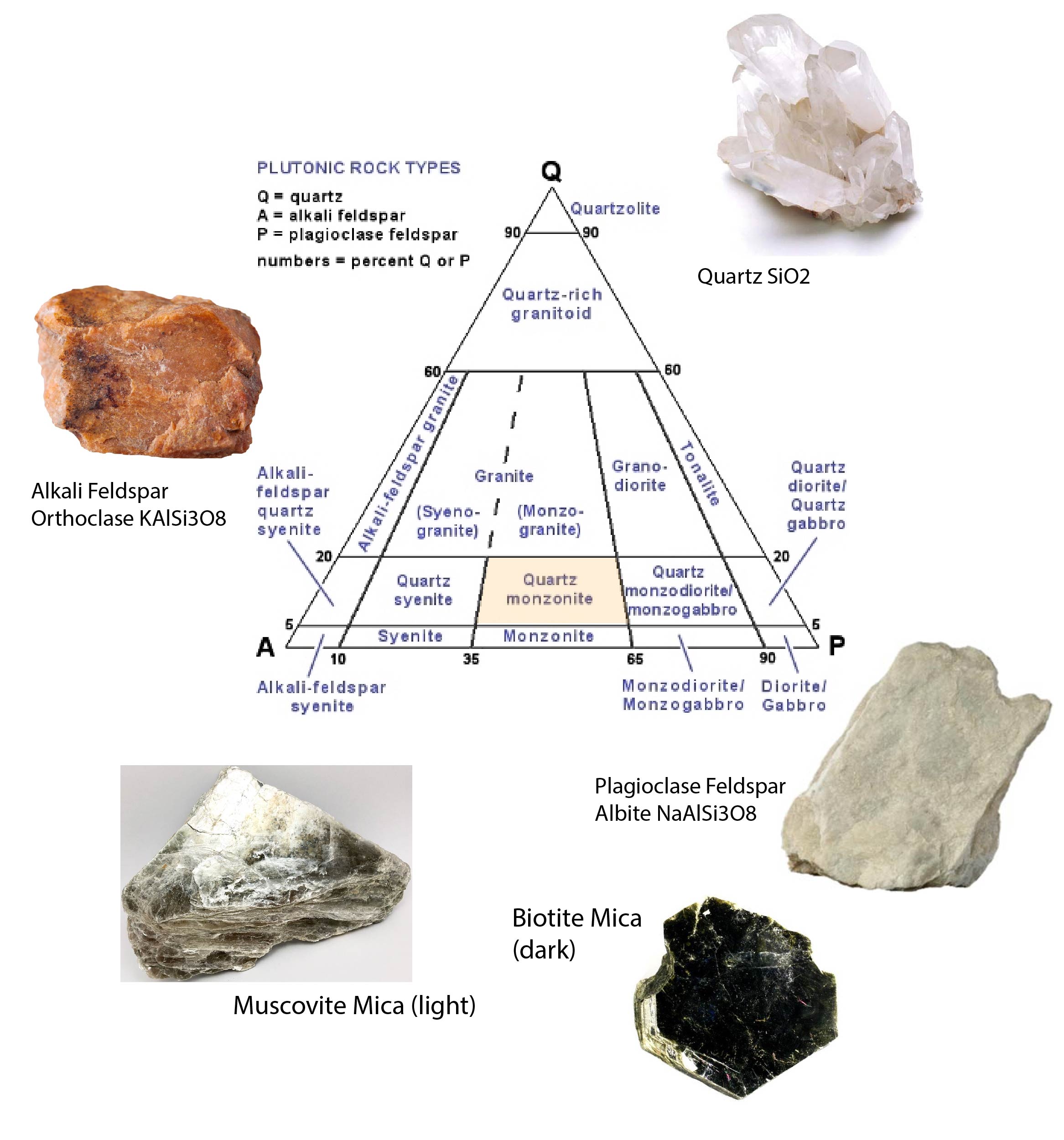
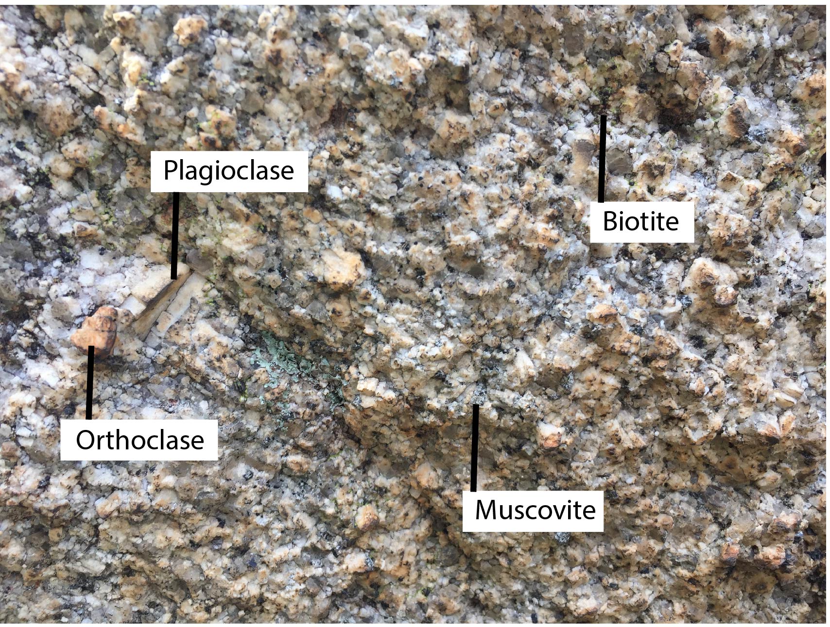
Lets put this into practice: below is a close-up image of the Kooyoora Granite (Figure 5). There appears to be equal parts Alkali Feldspar Orthoclase (pink) and Plagioclase Feldspar (white), very little quartz and equal parts Biotite and Muscovite.
If we go back up to the QAP diagram above and imagine the Kooyoora Granite is a little dot. Start at the top of the triangle. A granite sitting here would be more than 90% quartz and it would be called a Quartzolite. Looking at the sample above, there isn’t nearly this much quartz – it is more like 10% (bring the little dot down to below the ’20’ on the side of the triangle). From here we either move left or right depending on how much Alkali Feldspar (left) and Plagioclase Feldspar (right) there is. This sample has roughly equal parts, so we don’t move our dot anywhere… which makes it a Quartz-Monzonite! From just this hand-sample, you could also describe it as coarse-grained (phaneritic) with an even distribution of grain-size.

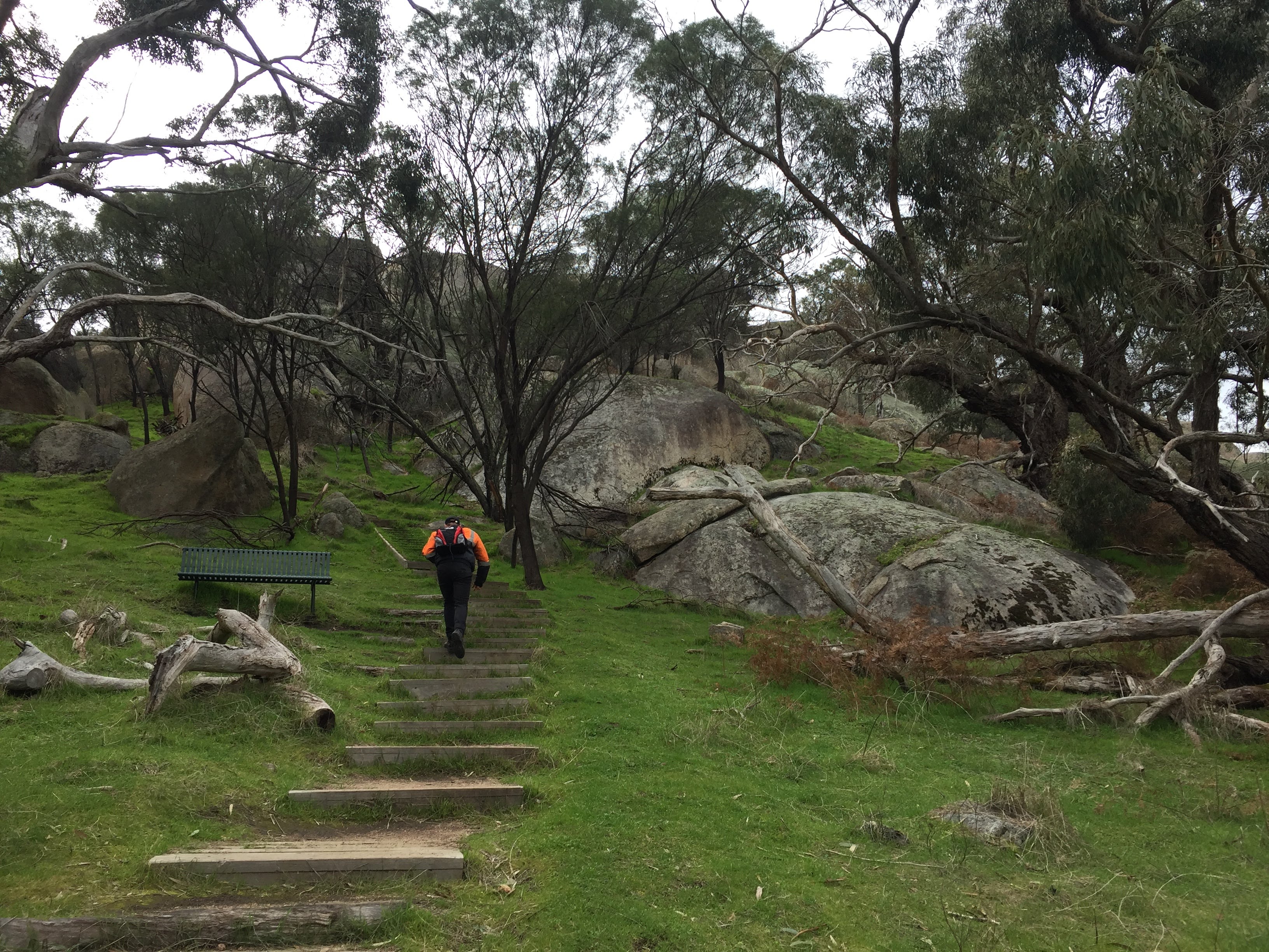
In general, the granites form low-lands with the preservation of a few tors (exfoliation domes, explained below) at the edges. The Kooyoora Granite, however, is different. It forms prominent hills, reaching a maximum height of 479m on Mount Kooyoora (Figure 2). The Kooyoora National Park covers most of the eastern outcrop of the granite, including the Melville Caves, and can be explored along paths of varying lengths (Figure 6).
I would work your way clock-wise around the park, parking your car at the Melville Caves Picnic Area and heading up the steps to the Melville Caves Lookout. From there continue past the Melville Caves Picnic Ground, then head south towards the Long Rock Walking Track which you followed back to the car park (about 3-4 hours walking).
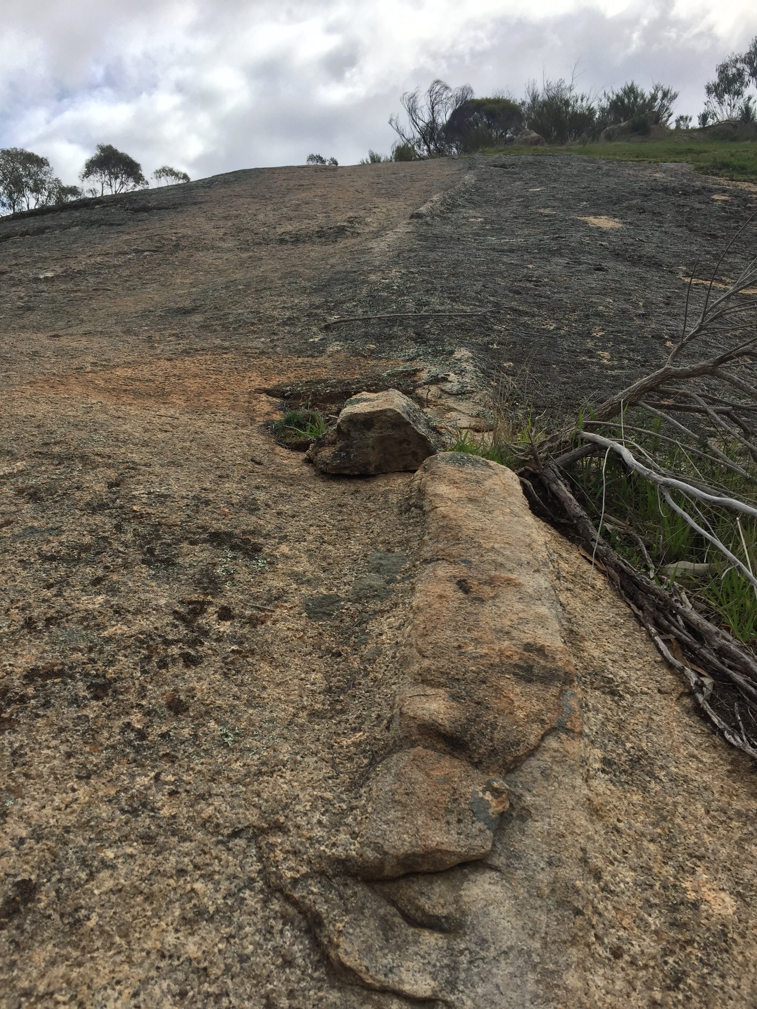
Walking along the ridge at Stop 3 in Figure 6 above, you may notice a long light-coloured linear feature (Figure 7). These geological features are Aplite dykes: fine-grained and quartz- and feldspar-dominant, however you can’t see this without a microscope as they are so finely inter-grown! Aplite dykes commonly occur in or around granitic intrusions. As they are so fine-grained, you can hypothesise that they formed later and cooled much quicker than the granite (grains cooled before they had the opportunity to grow).
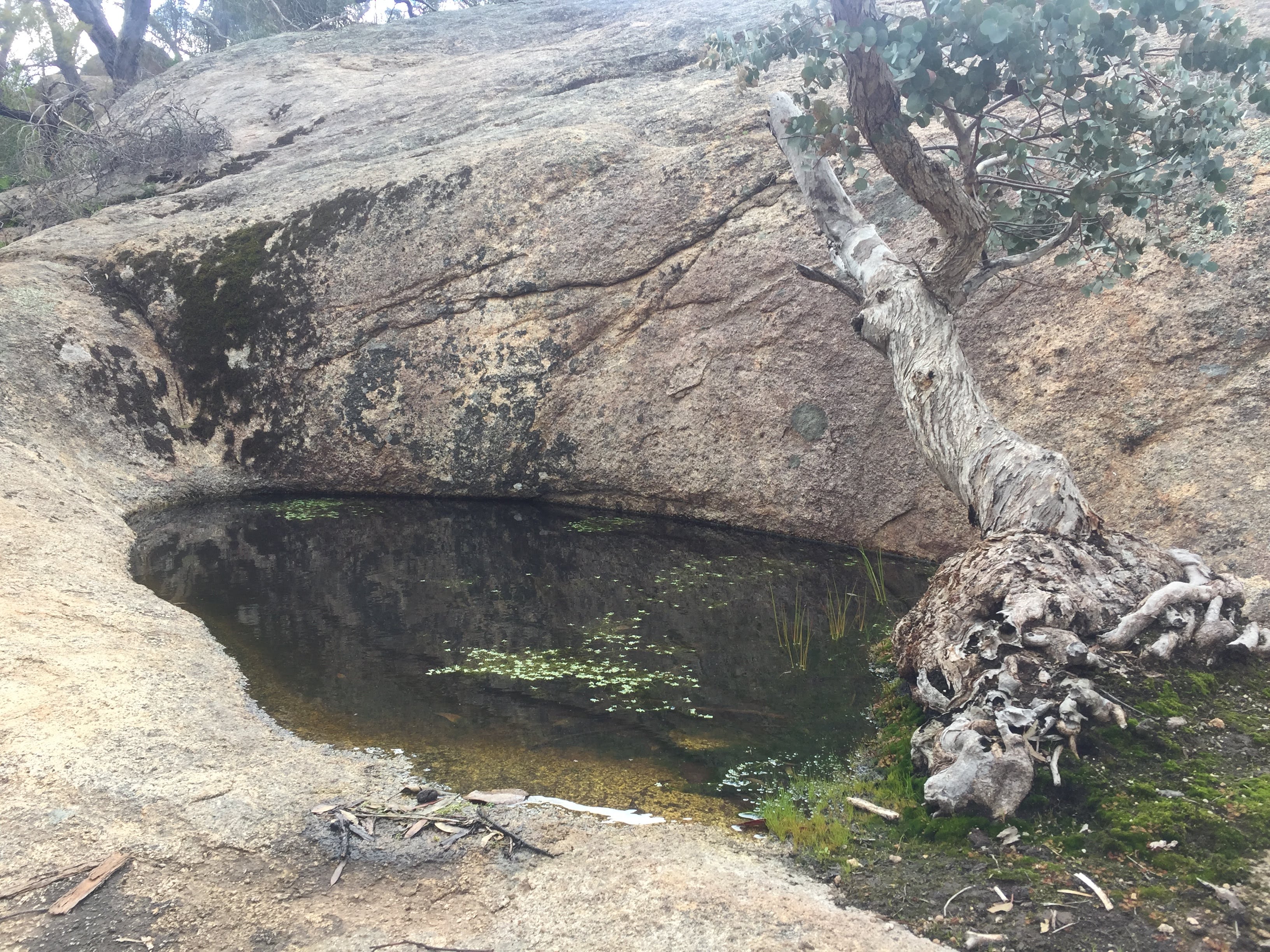
Around the nose of the rocky granite ridge at Stop 4 in Figure 6 there is a fairly deep rock pool. There are plenty of shallower rock pools which you would have passed before coming to this impressive example (Figure 8). These natural rock holes, called gnammas, were an important source of water for Indigenous people. Gnamma is an Aboriginal word meaning water-holding depression. They form by chemical weathering, a process where pits are created by the dissolution of minerals in a rock by pooling water. These natural water tanks were often covered by branches or leaves to prevent fouling of the water.
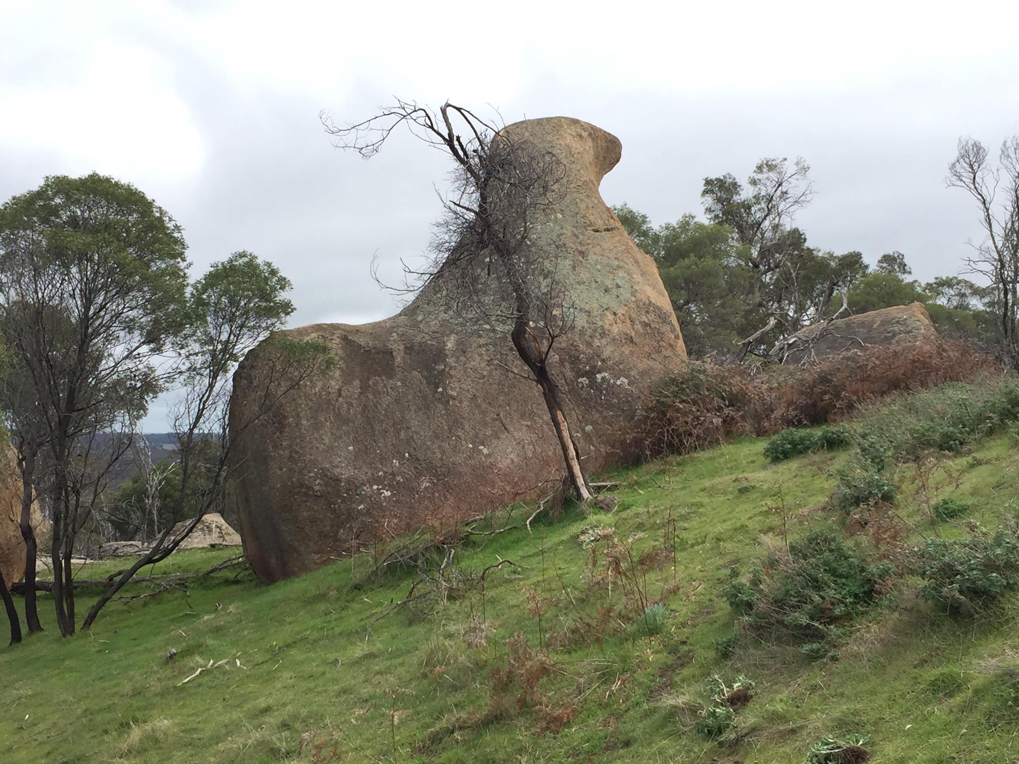
Passing the rock pool, the path heads down past some… precariously perched boulders (Stop 5, Figure 6). These boulders are called Tors. Looking at these rocks, you might wonder where they fell from – how did they get there?
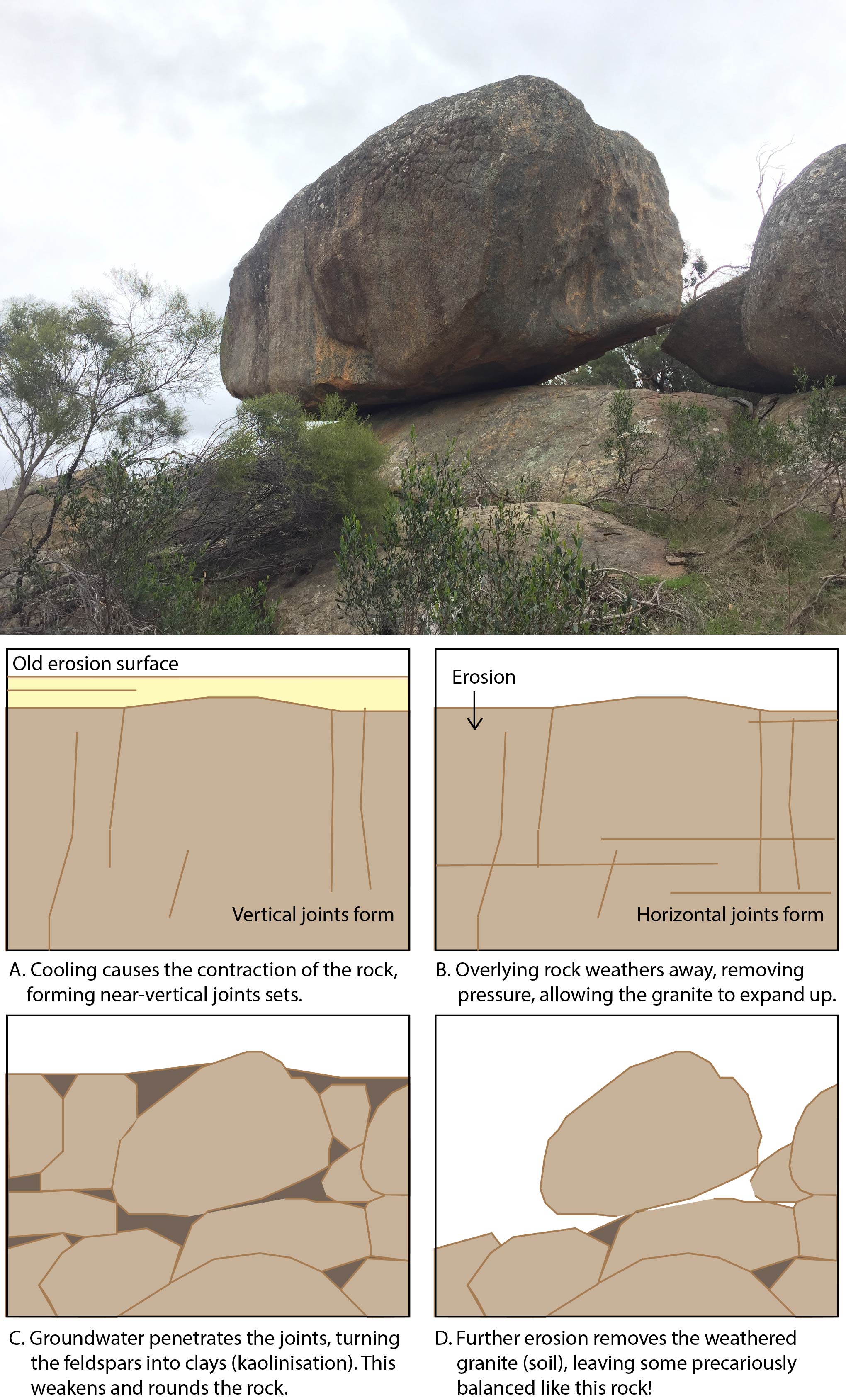
From the diagram above (Figure 9), I hope you have gathered that they don’t come from anywhere, in fact they’ve never moved! But at some point, given enough wind, this rock will certainly fall (more erosion).
This is not the only cool erosion feature you can observe in the park. Many of the granite outcrops have numerous small hollows forming honeycomb-like patterns similar to rocks you may have seen at the beach. At Stop 6, Figure 6 there is a nice example of this spherical weathering. We term these peculiar patterns tafoni. They form at the base of boulders, protected by an outer rim (Figure 10) and evolve as inverted saucers, enlarging upward into the rock mass as a result of salt crystallisation (source).

To the north of the Caves is the historic White Swan Quartz Mine (Stop 7, Figure 6) which operated during World War II, producing industrial and ornamental quartz. The open-cut is situated on a pegmatite dyke. Similar to aplite dykes, these generally occur on or near granite intrusions. Dissimilar to aplite dykes, however, pegmatite dykes are extremely coarse grained. Some pegmatite dykes may contain large rare or interesting minerals such as beryl, topaz or tourmaline. This pegmatite, however, has a fairly simple composition: quartz and feldspar with plumose muscovite.
‘Kooyoora’ (or Guyura) is a Dja Dja Wurrung word which translates literally to ‘mountain of light’. A natural spring exists at the Melville Caves site (currently re-routed to feed the toilet block), with large trees and diverse flora and fauna living at the site as a result of water availability. The significant rise in the landscape also provides shelter and a useful lookout spot and was thus an important meeting place for indigenous people for thousands of years.
We acknowledge the Jaara Jaara people of the Dja Dja Wurrung Nation as the Traditional Owners of the land upon which this field guide has been created. We recognise that many areas hold deep cultural significance for local Aboriginal groups and I hope you will keep this in mind as you explore the Park.

Leave a comment