

Maria Island is a special place tucked away off the east coast of Tasmania, consisting of two islands separated by a narrow isthmus. It is accessed via ferry from Triabunna, kayak/boat or charted flight. The island has a rich human history, including: convicts, whaling, industry and mining as well as geological history, including: limestone cliffs, dolerite intrusions and granitic exposures. You may even spot a Tassie Devil!
You can cycle most of the island (dark red path below) in a day or walk the whole island in two to three days. If camping isn’t your thing, you can stay in the historic buildings of the Darlington Probation Station (book rooms in advance) and make day trips. The three main tourist attractions, other than the ruins and historic buildings, are the Painted Cliffs, Fossil Cliffs and Bishop and Clerk hike.
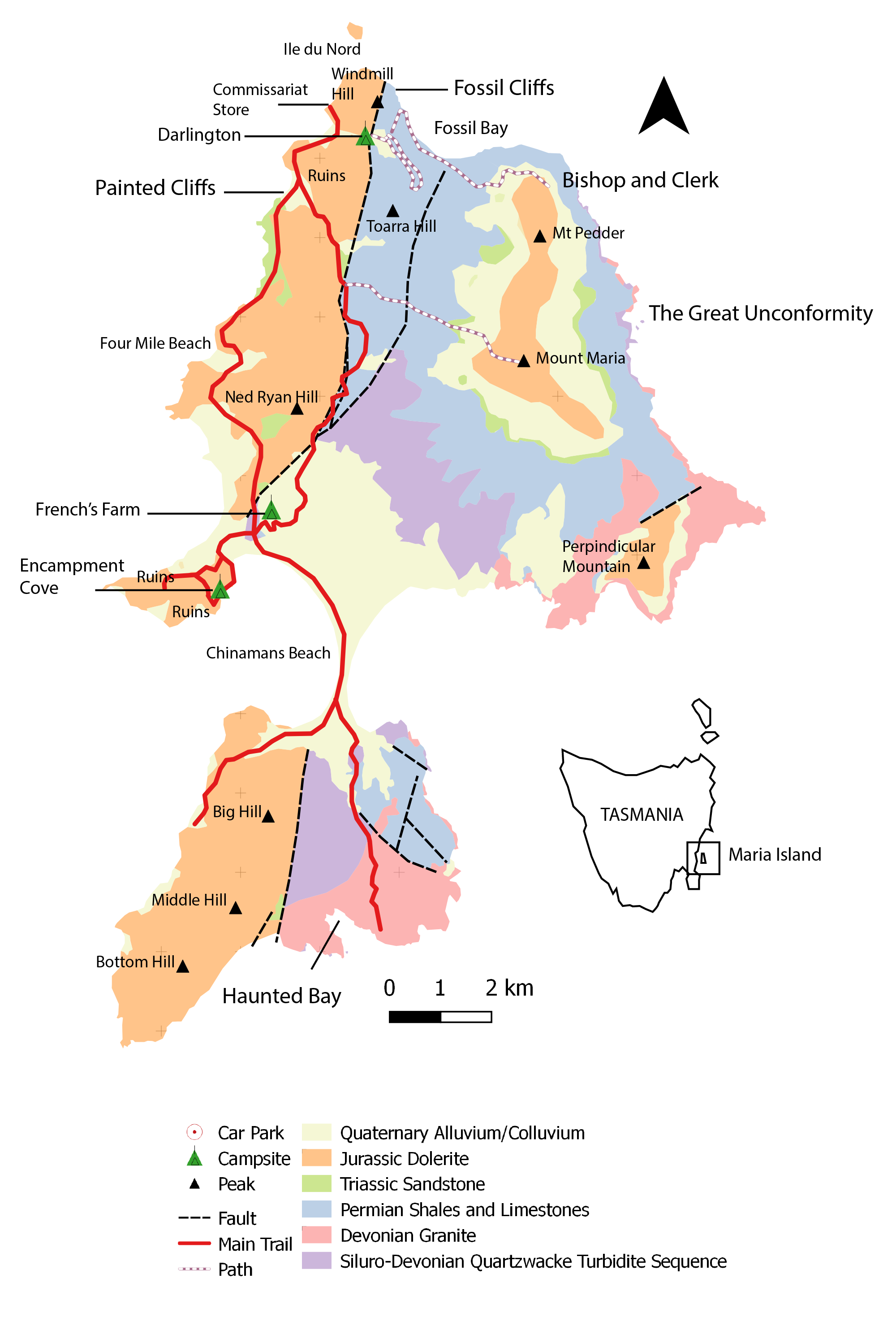
- Geological map of Maria Island, showing the main trail, smaller walks, campsites, peaks and major faults.
GEOLOGY
The Island is defined by rugged dolerite peaks in the north-east, including the twin peaks of Bishop and Clerk and, Mt Pedder (630m) and Mt Maria (709m) with more subdued lowlands in the south-west and steep granitic cliffs in the south-east.
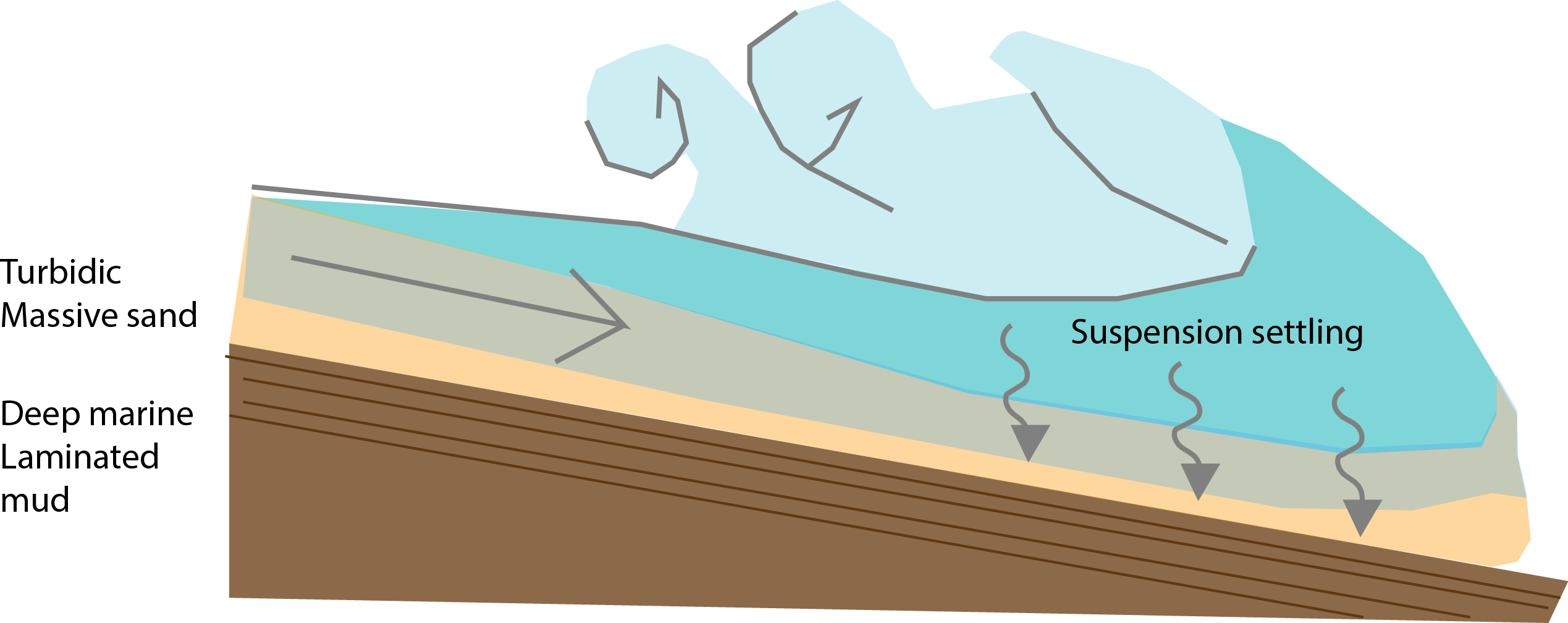
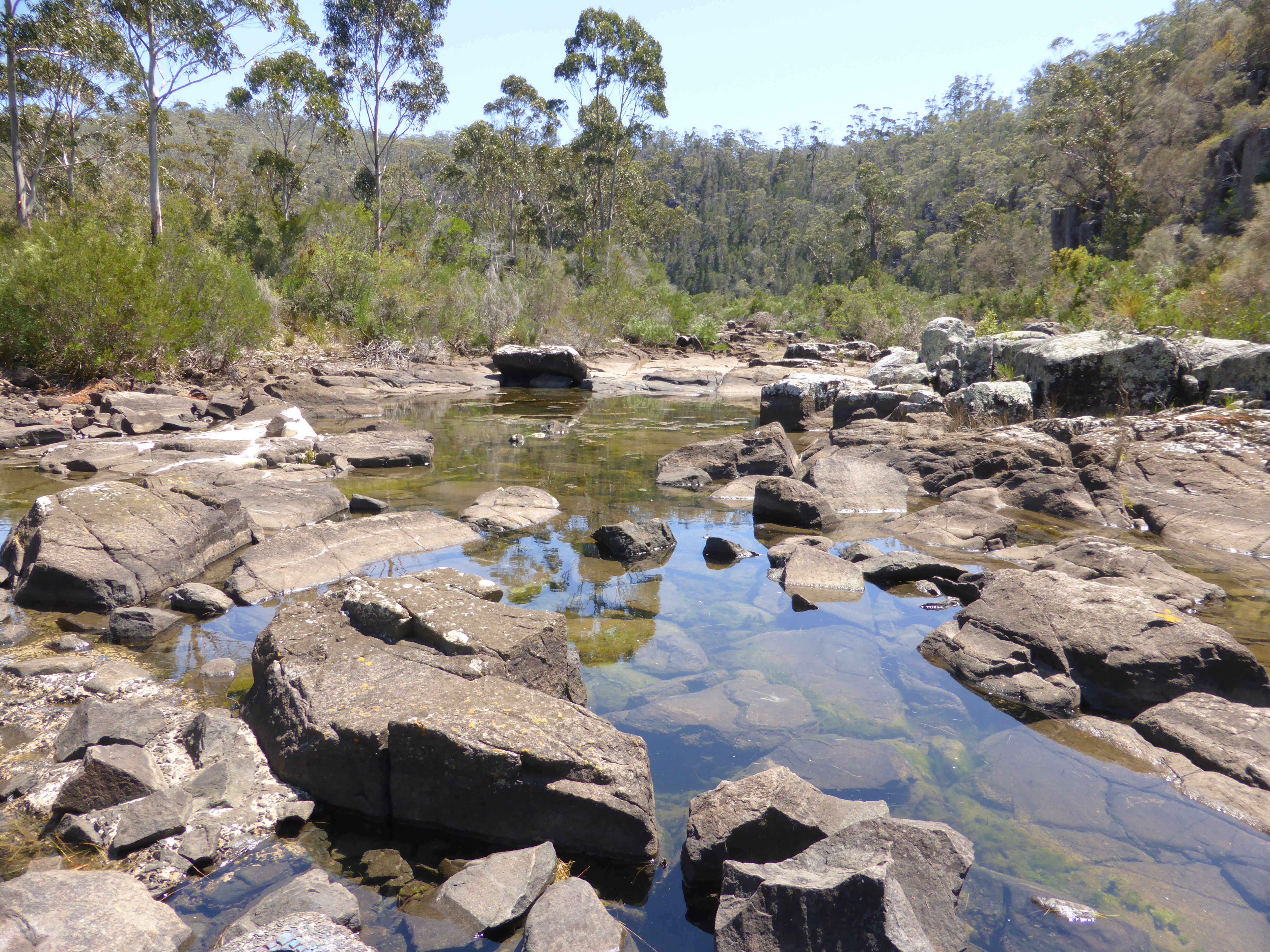
The oldest rocks on Maria Island are the Siluro-Devonian (440-360 million years old) Quartzwacke Turbidite Sequences, called the Mathina Beds (Purple in map above). You can see them directly south of Four Mile Creek as well as along the southern walk towards Haunted Bay. The Quartzwacke (i.e. quartz-rich sandstone) formed from turbidity currents in a deep marine water environment. Turbidity currents are like landslides and can occur as a result of earthquakes (see image below).
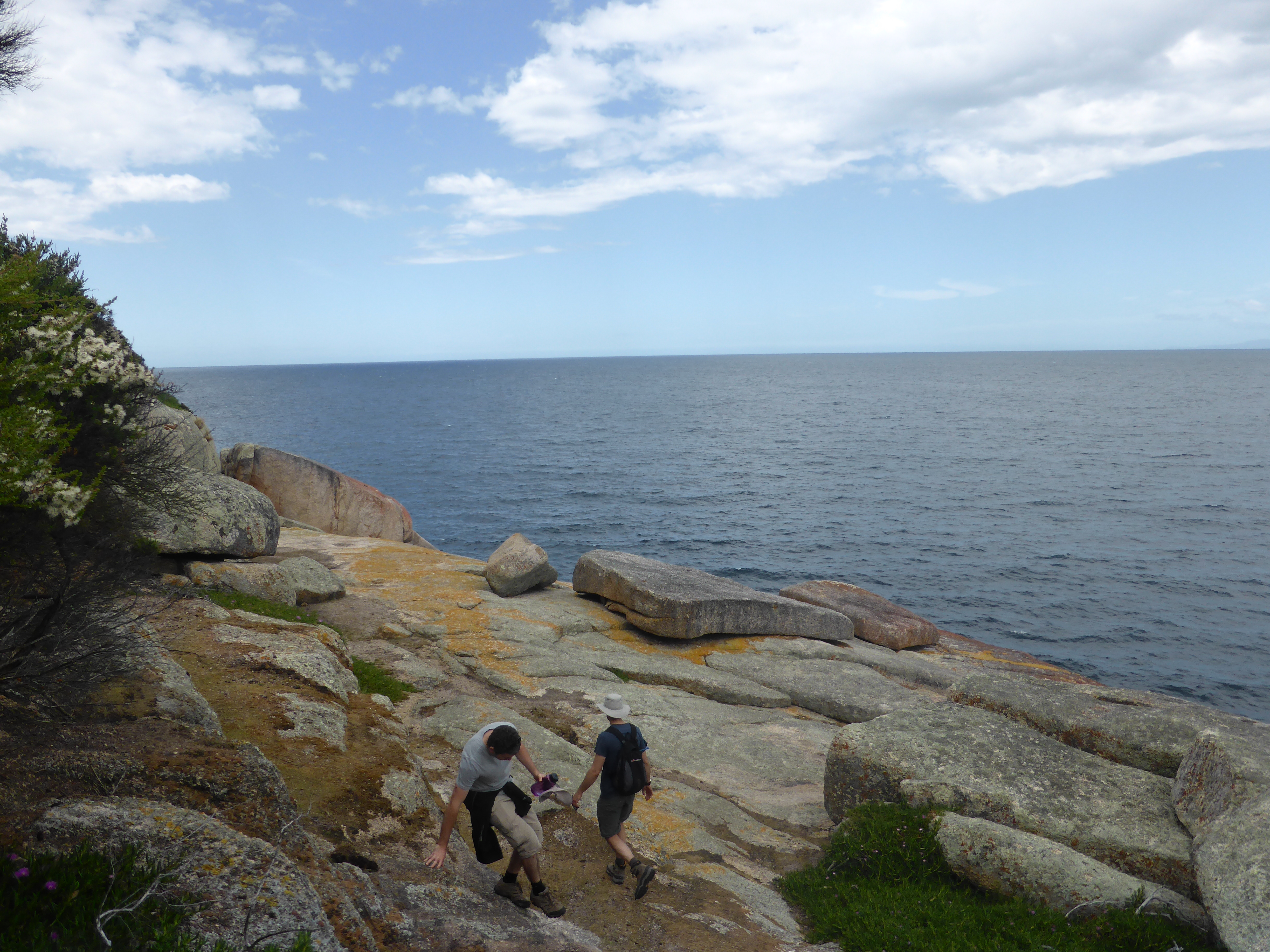
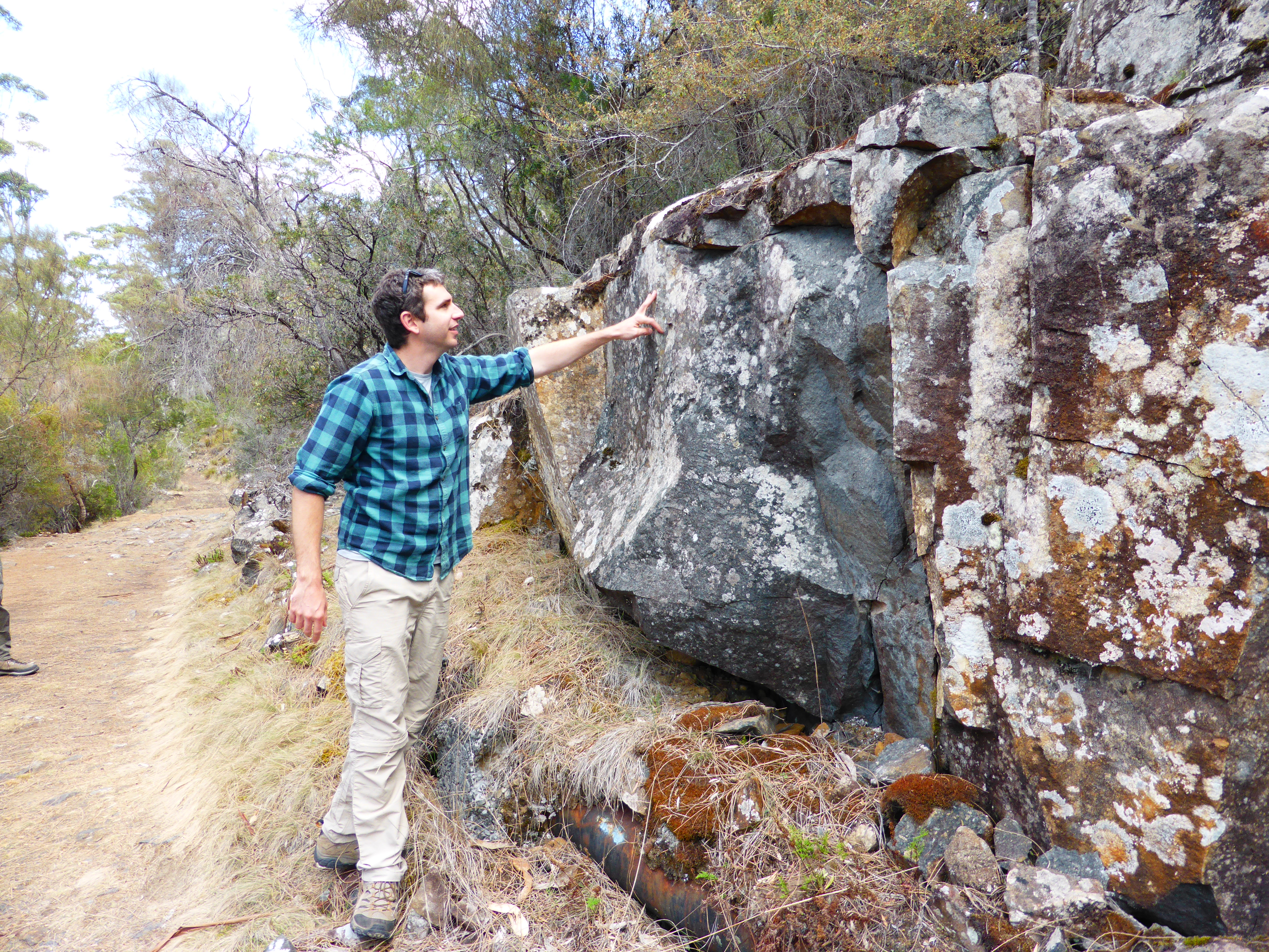
The Mathina Beds are intruded by coarse-grained alkali Devonian granite, producing thermal metamorphic aureoles of up to 1 km. The alkali part of that name explains why the granite looks pink/red. It has a high abundance of K-Feldspar (Potassium), which weathers to this colour. The granites are best seen at Haunted Bay on the southern end of the island.
Thermal (contact) metamorphic aureoles form when hot magma pushes up into the cooler crust (e.g. sandstone) and literally cooks it. This can cause different mineral assemblages to form in the surrounding rock (zones).
These folded basement rocks are abruptly cut-off by an unconformity – a period of significant erosion – and overlain by flat-lying Permian (300-270 million years old) mudstones called the Parmeener Super-Group. Unconformities are very important in understanding a fundamental concept of geology: Superposition. In a nutshell: the oldest layer will be at the bottom. Periods of deposition can be interupted by erosion, a.k.a. some rocks (and therefore fossils) are missing!
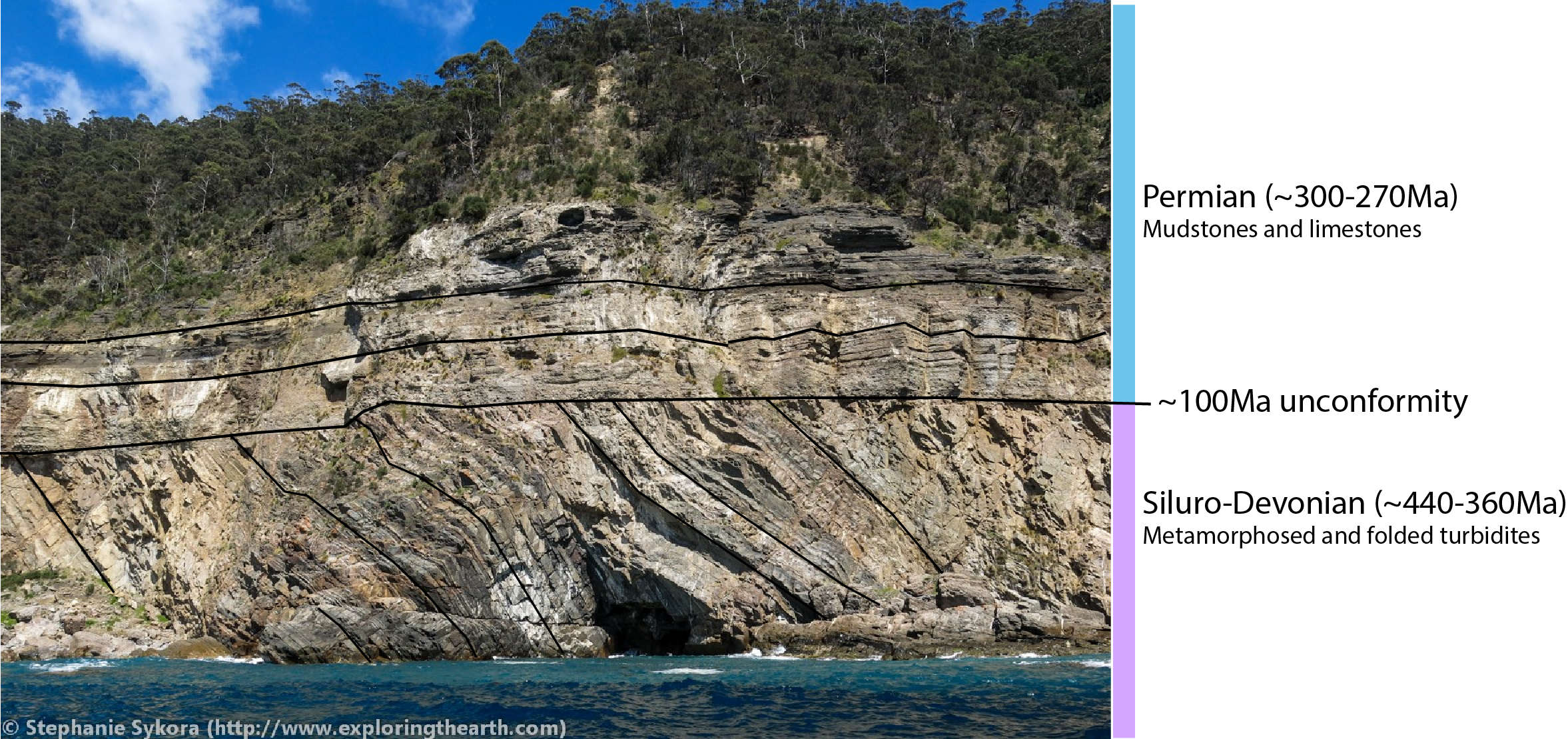
The Permian Parmeener Super-Group is split into a Lower entirely marine sequence and an Upper freshwater sequence. The Lower sequence is variable but predominantly composed of fossiliferous limestone and coarse-grained sandstone. This is the group that is exposed at Fossil Cliffs. The Permian was a time of glaciation as evidenced by dark grey tillites in basal layers and mudstone with dropstones. The fact that marine life in this part of the world managed to thrive in a polar environment, as evidenced by the co-existance of fossils and glacial deposits, makes this site very special!

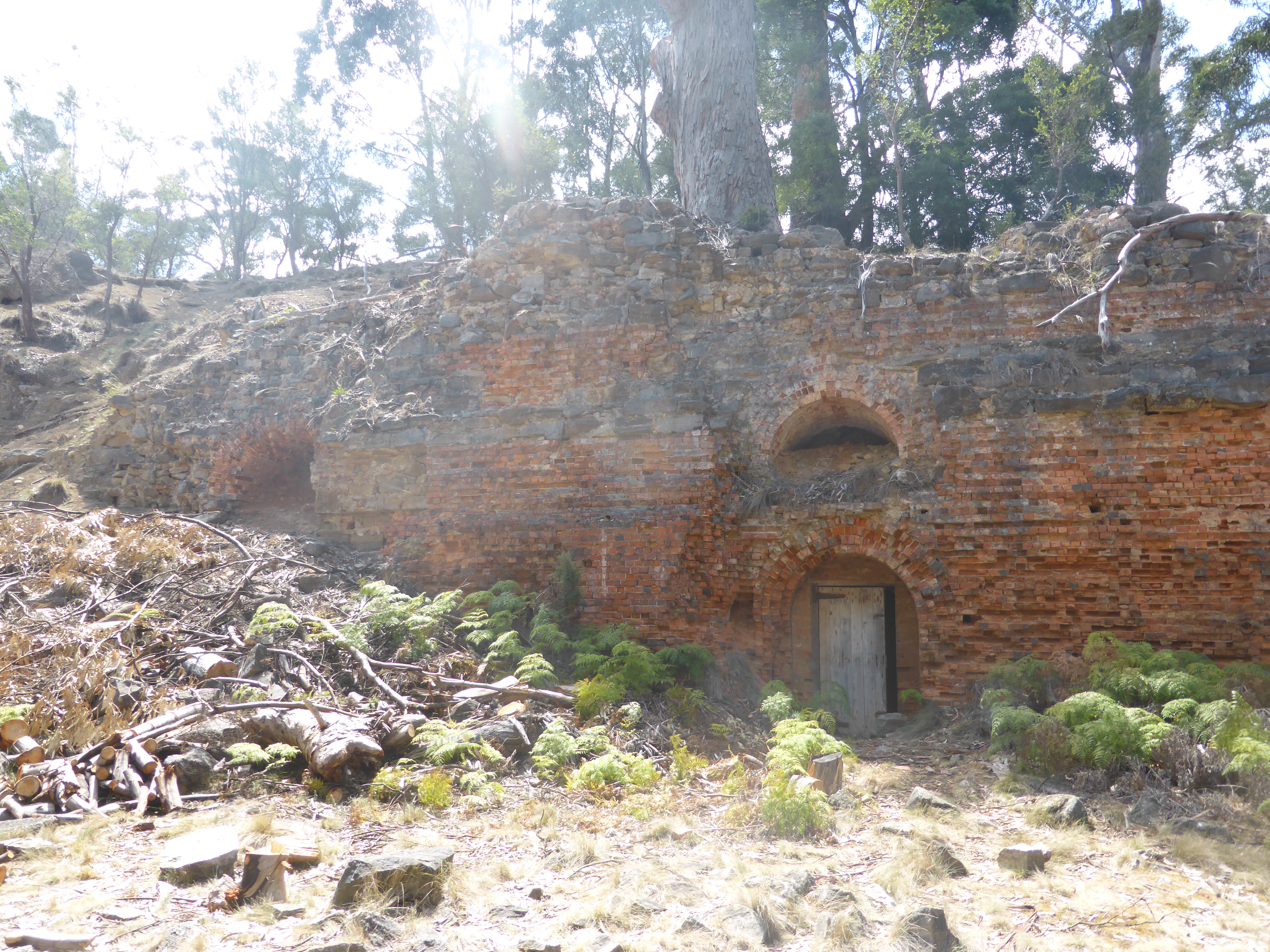
A sub-unit of the Lower Super-Group is the Darlington Limestone. This was quarried from the late 19th-Century until 1930 to make cement and lime.
The Parmeneer Super-Group is intruded by Jurassic Dolerite, a fine-medium grained intrusive. In fact, one-third of Tasmania is intruded by major sheet-like bodies of dolerite in the Jurassic Period. The magma intrusion was so huge it also affected other continents such as Antarctica and South Africa. The intrusion also coincides with the begining of the break-up of the super-continent Gondwana – a process that continues today!
The large fault which cuts through the guts of Maria Island north-south (see map above) developed in the Tertiary period, up-thrusting the eastern-half of the island and allowing the older layers to be exposed for us to look at today!
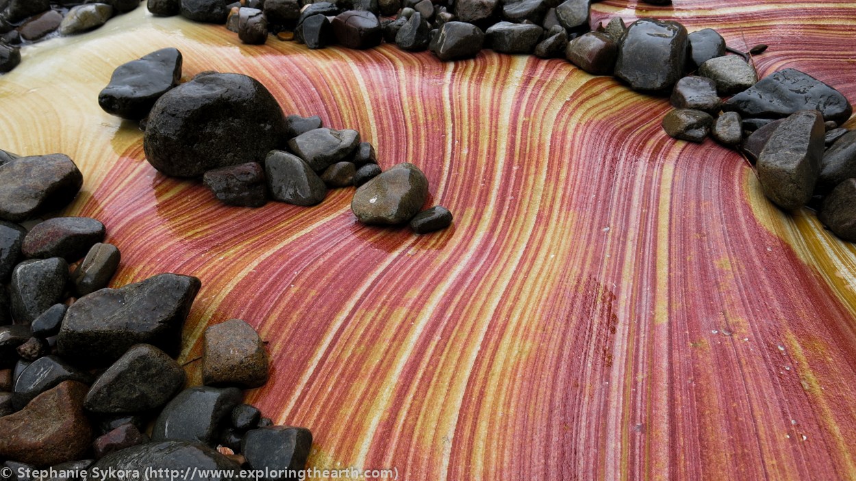
We can also thank the dolerite intrusions for the beautifully coloured Painted Cliffs of Maria Island.. Outcrops of siliceous Triassic Sandstones (green in the above map) – which overlie the Parmeneer Super-Group – are restricted to the edge of the island, including the Painted Cliffs site. The patterns are caused by Iron-oxide staining as a result of groundwater leaching through the porous sandstone.
EUROPEAN HISTORY: ORFORD
If you get to the ferry early, I’d encourage you to to check out The Old Convict Road five minutes South of Triabunna at Orford. The chiselled bluestone road is easy to find, starting just North of the Prosser River behind Orford Riverside Cottages.
Constructed between 1841 and 1855, the road was built by convicts to service a Probation Station called ‘Paradise‘, where they were most likely also housed.
In Tasmania, Probation Stations were an attempt to house and administer gangs of convicts, who were classed according to how close they were to release. When we visited we were lucky enough to run into archaeologists doing some preservation work at the site.
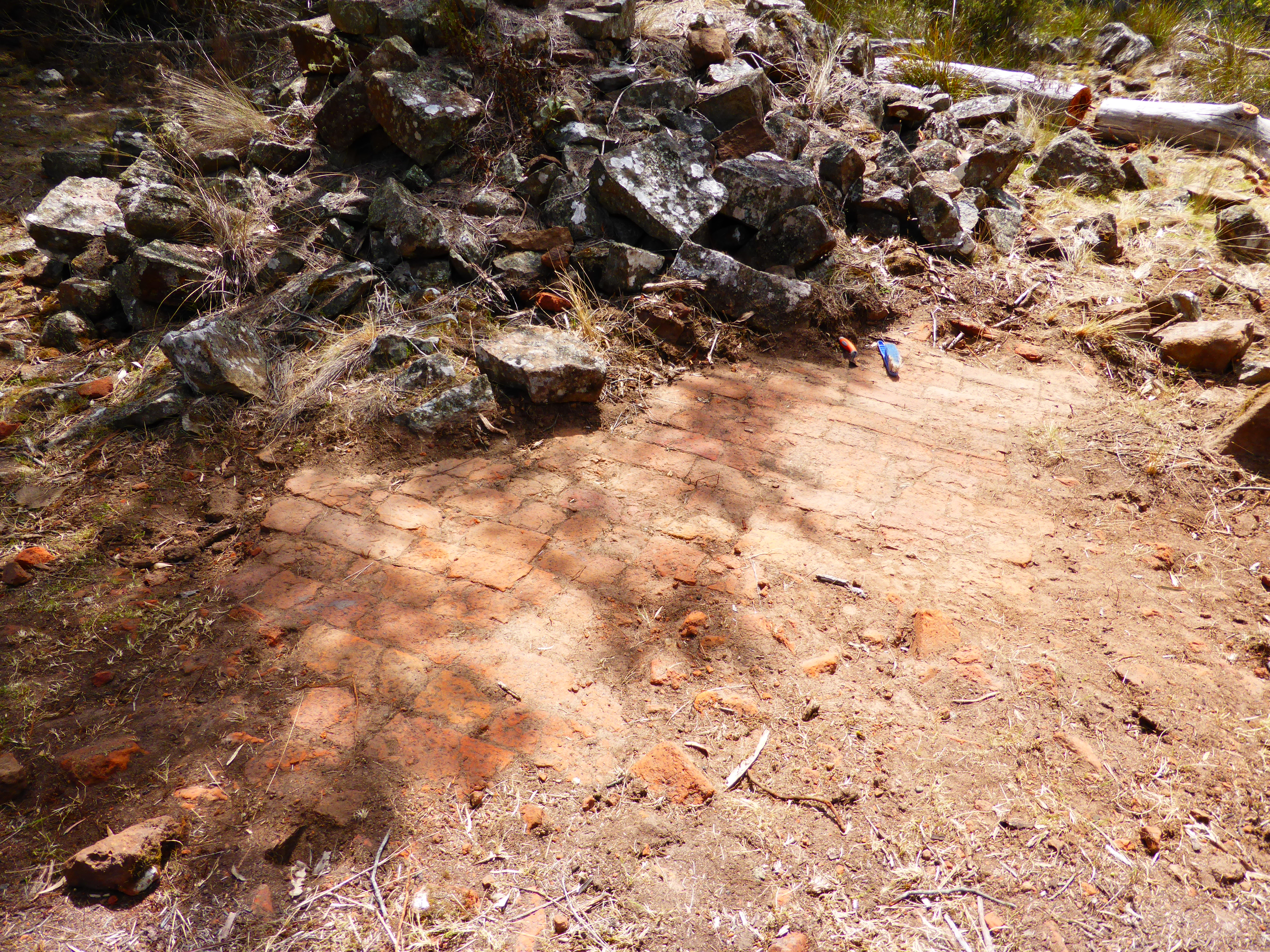
We were taken on a tour of the site, including: the old cells, fireplaces, a potential jetty and an old lime kiln. It is an interesting experience in how geology can have a direct influence in land formations and human history – and, a good introduction as to what to expect on Maria Island itself.
ADDITIONAL NOTES
There are no shops on the island, so you will have to make sure you are prepared with enough food, water and warm clothing. If you are camping, ensure you are able to tie up or by another means keep food away from animals. Wombats have been known to tear holes in tents, and we were bothered a couple of times by hungry Tasmanian Devils.
Check the Parks Tasmania for bookings and any current warnings or closures.
We acknowledge the the Oyster Bay Nation as the Traditional Owners of the land upon which this field guide has been created. We recognise that many areas hold deep cultural significance for local Aboriginal groups and we hope you will keep this in mind as you explore wukaluwikiwayna (Maria Island).

Leave a comment