

Heathcote is a small town North of Melbourne, renowned for gourmet foods and distinctive wines – specifically its stunning Shiraz. It is also a hot spot for prospectors on the hunt for Gold and – surrounded by National and State Parks – a popular destination for bush walkers and twitchers alike.
There are, however, many stories yet to be discovered in this spectacular region. Stories of monumental glaciers tearing across the landscape leaving deep grooves in the rocks beneath, magma rising vertically through cracks in the Earth as hot wax moves in a lava lamp, bearing different minerals to the surface, and an ancient ocean floor bursting with the evolution of unfamiliar animals such as trilobites from a complex soup of microbes.
Below are three things: a geological map, a cross section of the region and a ‘legend’ that explains what all of the colours mean. A cross-section is essentially a vertical slice through the landscape… if the soil was vanilla icing, the mountains were sugary jubes, the ridges were snakes and the layers of rocks were actually layers of sponge separated by cream… you’d have a slice of cake to eat and also the cross-section below. The position of the cross-section is denoted by the black line in the geological map.
GEOLOGICAL MAP
CROSS-SECTION


TIMELINE (OLDEST TO YOUNGEST)
The Heathcote Stratigraphy is dominated by marine rocks which were deposited along the margin of the Gondwana landmass from the Cambrian to the Early Devonian (see Geology of Victoria to learn more about Gondwana).
VOLCANISM
Quaternary (15-5 Ma)

The lava that flows down the Coliban and Campaspe river valleys are made up of rocks that look like the piece of basalt above from Axedale. There have been extensive lava flows in the region over the last few million years but luckily.. not in recent history.
How to identify it:
Basalt can be identified by its fine grained minerals, the dark colour of the minerals, enrichment of Iron and all of the little holes – called vesicles – in the rock.
Where to see it:
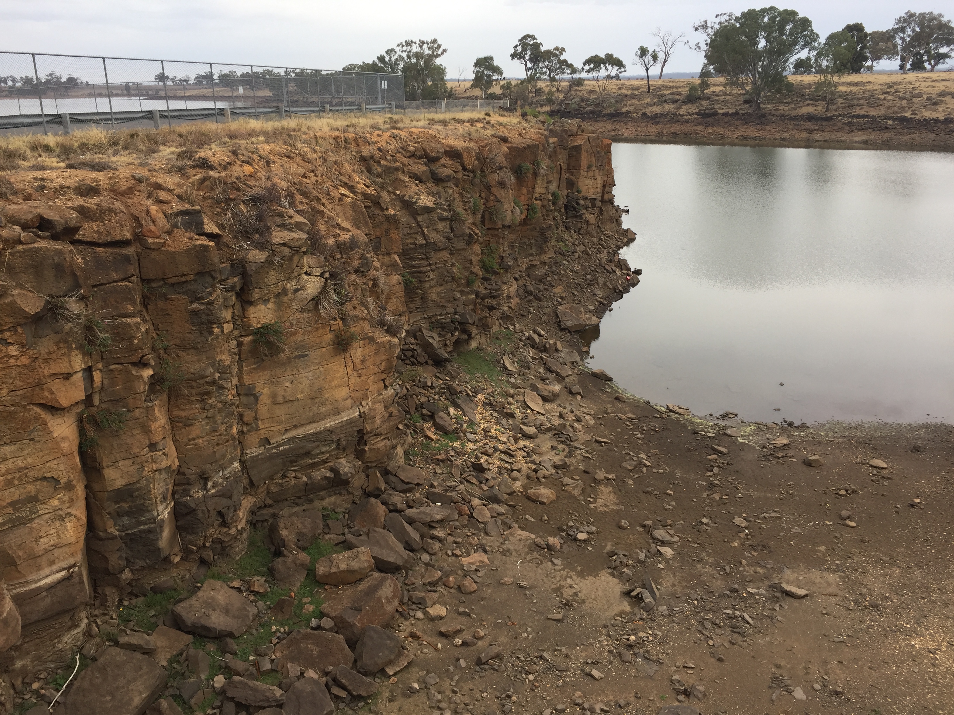
- Lake Eppalock Spillway Lookout.
- Turpins Falls.
GLACIATION
Permian (300 – 250 Ma)


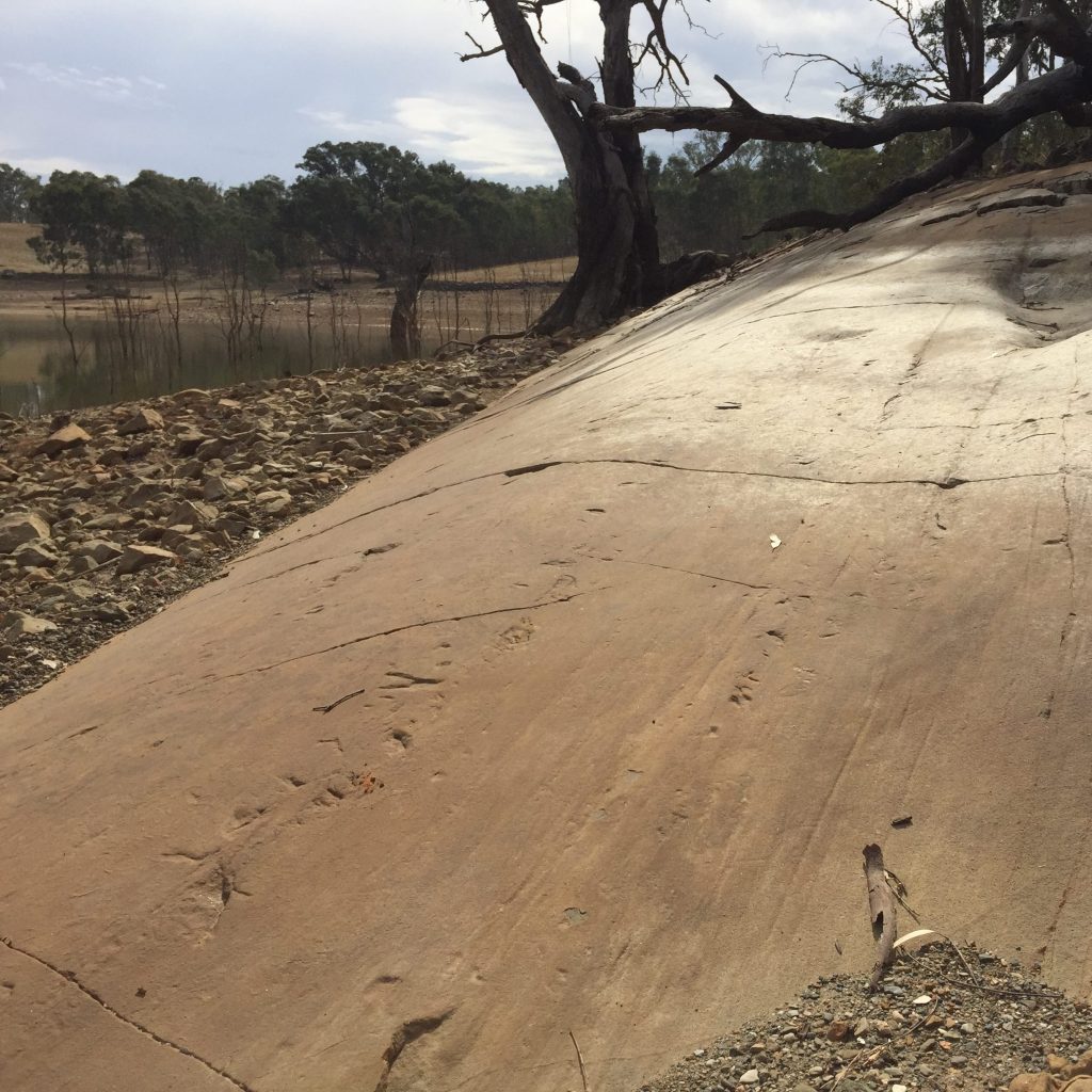


In the Late Carboniferous and Permian Gondwana experienced a prolonged Ice Age. Most Permian deposits were eroded in Victoria and so the Permian deposits at Heathcote are quite rare!
How to identify it:
Glacial tillites (the ‘glacial conglomerate’ above) can be identified by the loose compaction of often rounded diverse types of rocks in amongst a matrix of fine-grained mud. Look for deep groves on these rocks – these are called striations and are evidence of the glacier moving, very slowly, like a river of ice.
Where to see it:
- Moorabbee Geological Reserve (glacial striations, tillite, erratics).
- O’keefe Rail Trail Parking (Stranger Rock, diamictite in wall of path).
GRANITE INTRUSIONS
Devonian (370 – 300 Ma)
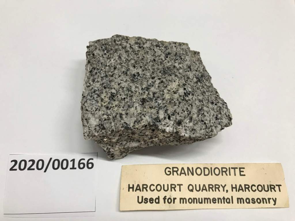


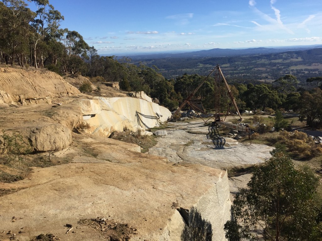
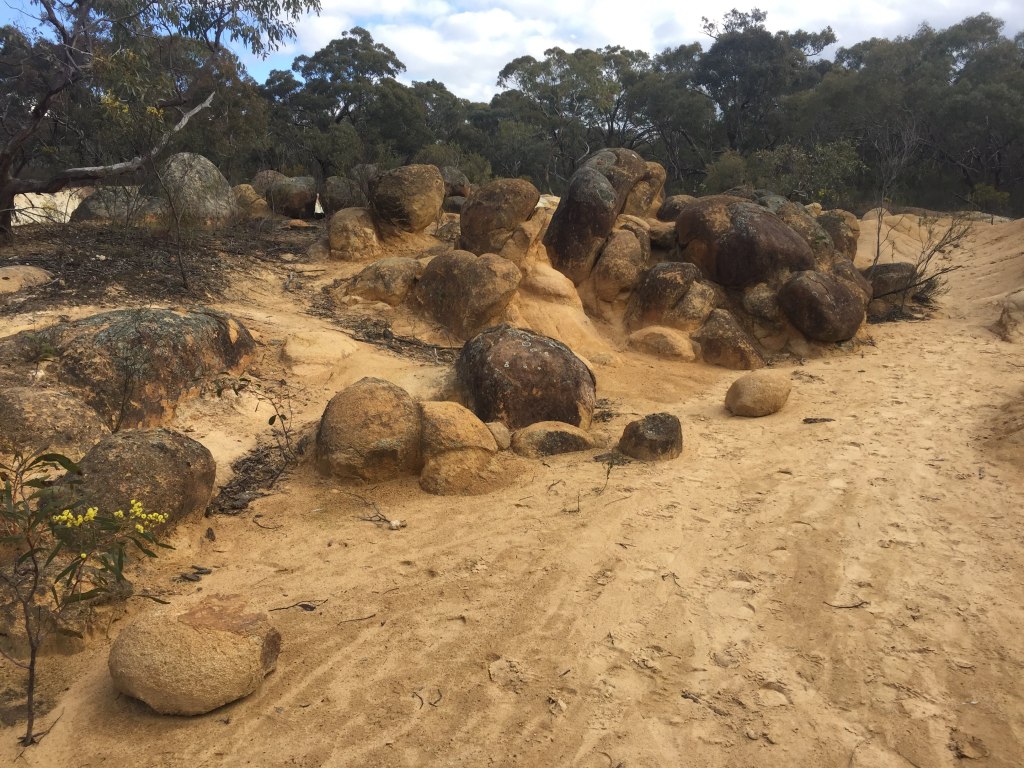
In the Devonian the crust was intruded and metamorphosed (heated) by granites and subjected to prolonged erosion. Granites in the region were extensively mined to form granite blocks used as building materials all around Victoria.
How to identify it:
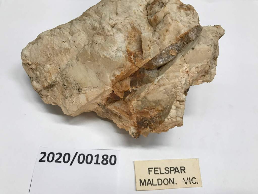
Granites can be identified by their big grain size, light colour and crystalline shape of the minerals. Granites usually contain a combination of Quartz (clear), Feldspars (opaque white/pink), Biotite (black flakes) and Muscovite (light brown flakes). Sometimes there will be fine-grained lines through the granite, we call these felsic dykes. Granite often weathers to form round and often precariously balanced boulders or ‘tors’.
Where to see it:
- Pink Cliffs Geological Reserve.
- The Cascades swimming hole.
- Mount Alexander Regional Park.
- McHarg Ranges and Tooborac.
INFILLING OF MELBOURNE TROUGH
Silurian- Devonian (435 – 370 Ma)

The Silurian and Devonian sediments in Heathcote accumulated on the continental shelf along the eastern margin of the continent. The actual position of the shoreline migrated east and west as sea levels rose and fell. Rocks of this age can be recognised in road cuttings as a monotonous sequence of mud dominated sediments and coarser grained sand dominated sediments, rinse and repeat. The size and sorting of sediments can be used to interpret what the environment was at the time of deposition – was it a beach with waves and sand? Or a deep sea shelf with the calm deposition of soft fine-grained muds? Are there fossils? Are there lots of layers? Or just one big sandy one?
How to identify it:
435 – 420 Ma: The Costerfield Siltstone is the oldest unit, representing a calm, deep-water environment (siltstone) and often contains bioturbation, which is fossil evidence of bottom-dwelling creatures mucking around. The Wapentake Formation represents discrete pulses of turbidity currents (sandstone) sourced from land, flowing deep into the sea. The Dargile Formation represents a return to a calm, deep-water environment (siltstone).
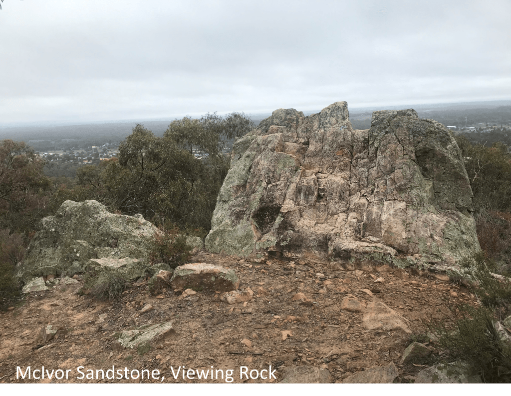
420-402 Ma: The McIvor Sandstone and Mount Ida Formation located at Mount Ida represents the position of the shoreline of the Melbourne Basin at this time – a nearshore shallow water environment such as a sandy beach and may contain fossils. This was followed by a sudden deepening of the entire Melbourne Basin and a return to mud deposition. The Broadford Formation represents a sudden influx of coarse-grained clastic material transported by turbidity currents which carved large channels through the mud. The Puckapunyal sediments represent calm depositional environments and are characterised by finer grained more thinly bedded sediments.
Where to see it:
- Mount Ida.
- Viewing Rock, McIvor Range.
- Costerfield Mine.
GOLD FORMATION
(420 – 380 Ma)

Folded turbidites with quartz veining in anticline (fold), underground at Fosterville Gold Mine 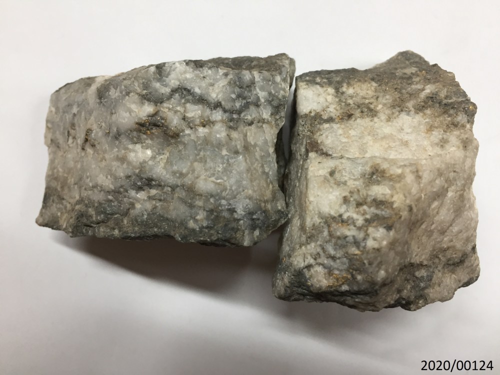
Gold in quartz, Central Deborah Gold Mine 
Antimony (Stibnite), Costerfield Mine 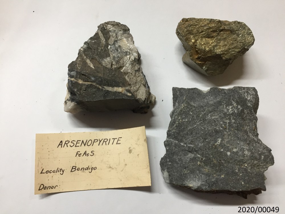
Arsenopyrite, Bendigo 
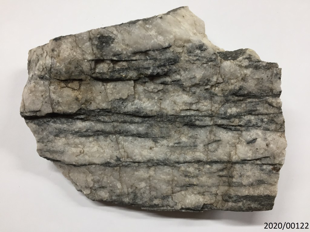
Quartz, Bendigo 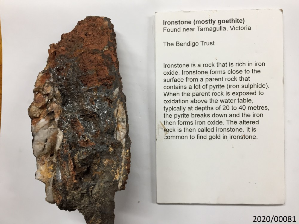
Ironstone, Tarnagulla 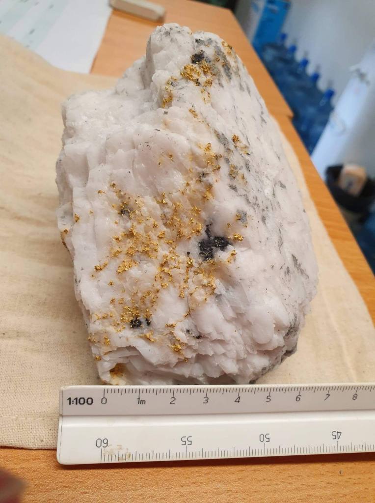
Gold in Quartz, Fosterville Gold Mine 
Mineralised Quartz Veins in Open Cut, Victoria Hill Mining Reserve
Gold Mineralisation occurs across the Heathcote Region, including: Castlemaine, Bendigo and Fosterville in what is structurally termed the ‘Bendigo Zone’ (grey in the map above), Heathcote in what is termed the ‘Heathcote Fault Zone’ (light purple in the map above) and Costerfield in what is termed the ‘Melbourne Zone’ (various shades of green in the map above).
Timing of gold Mineralisation across the region is poorly constrained, however all gold is formed in rocks Devonian and Older. Most evidence points to a major gold-forming deformation event in the Silurian during a period of high geothermal gradient and magmatism. You can learn more about the setting of mineralisation here.
The first recorded Gold Discovery in Heathcote was made in January 1852 in the McIvor Creek near Heathcote. Gold is the most important metallic mineral in Heathcote, with numerous historical goldfields across the region, including: Axedale, Bendigo, Castlemaine, Costerfield, Fosterville, Graytown, Heathcote, Redcastle, Rushworth and Toolleen. The two currently operating mines in the region are Costerfield, which mines antimony and gold and Fosterville Gold Mine, which mines gold.
Other important resources mined in the region include: antimony at Costerfield (mainly used in munitions and battery products), manganese at Bald Hill (Flea Street, Heathcote), copper, silver, lead, nickel, chromium, iron, platinum, tungsten, talc, magnesite and gemstones.
DEEP MARINE TURBIDITE DEPOSITION
Ordovician (485 – 435 Ma)


The sediments deposited in the Ordovician covered all of the Cambrian Volcanics through turbidity currents and deep water deposition, called a submarine fan.
How to identify it:
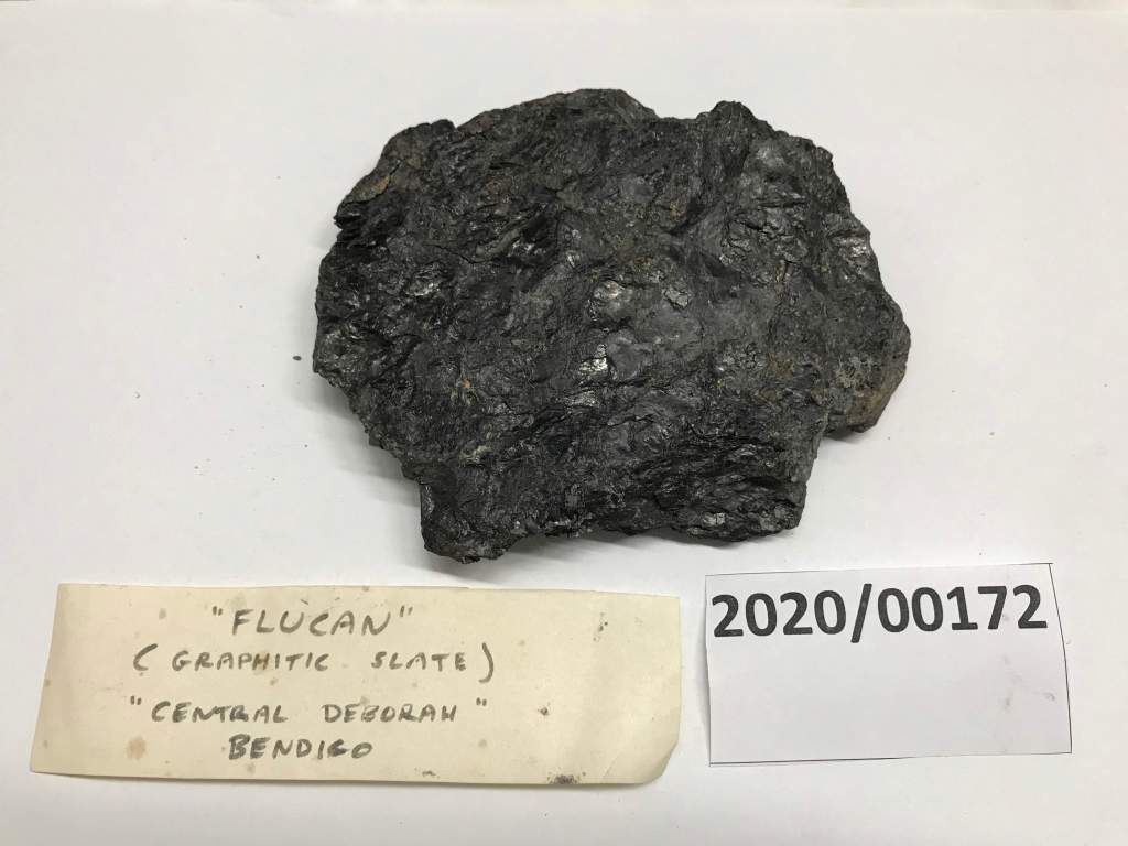
The sandstones and shales of the Ordovician are sedimentary rocks, which means the form from the erosion of metamorphic and igneous rocks (i.e. mountains). You can identify them by how large the grain size is. Coarse grained generally will be a sandstone (or psammite, arkosic sandstone, quartz arenite, quartzite depending on metamorphism) and fine grained will generally be a mudstone or siltstone (or pelite, slate depending on metamorphism). Use the images above to help in identification.
Where to find it:
- Many, many road cuttings throughout the region
- Castlemaine Diggings National Heritage Park
- Castlemaine Anticlinal Fold
- Central Deborah Gold Mine
- Victoria Hill Mining Reserve
CREATION OF OCEAN FLOOR
Cambrian (570 – 485 Ma)

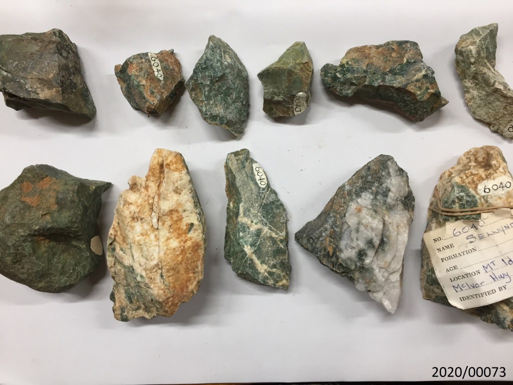
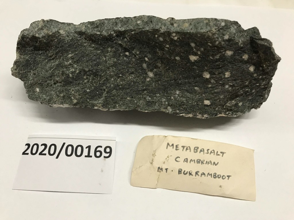


During the Early Cambrian, an ocean floor developed along the eastern margin of the Australian Craton, depositing volcanic rocks (greenstones) and pelagic sediments (cherts). These volcanics probably underlie all of the Heathcote Region, only outcropping along the narrow north-south trending belt you see in the map above.
How to identify it:
The photos of the rock specimens above are fairly descriptive to assist in identifying the chert, greenstone, basalt, Selwynite and Axinite. Unfortunately, there are not very many publicly available places to view these rocks up close.
Where to find it:
- All wineries in the Heathcote Wine Region!
- Lady’s Pass (Jasper and Chert)
- Highway adjacent to Mount Ida
- Red Hill Mine
WHY IS ROCK TYPE IMPORTANT?
The Heathcote region is a fantastic region to explore the three main types of rocks: igneous, sedimentary and metamorphic. And even more, the difference between deep marine and shallow marine sedimentary rocks and felsic and mafic igneous rocks.
If you walk through through any of these geological units (check the map) see if you can make connections between the unit on the map and what you see beneath your feet.
Rock types will generally determine what kind of topography the land will have, whether it be a tall ridge line (as with the light yellow McIvor Sandstone), a smooth creek or flood plane (as in the dark yellow recent volcanics) or rolling hills (as in the dark pink granitic intrusions). Open the map above in a new tab and change the base map to topography to explore these relationships. Often the change from sandy to muddy layers will correspond to hills (sandy) and valleys/creeks (muddy) due to differences in weathering.
Rock type will also have an important influence on what land is used for. Look carefully at the location of the wineries on the map. What rock unit do they occur on? Volcanic rocks are made up of elements like aluminium, iron, magnesium, calcium, sodium, potassium and phosphorus… which happen to be wonderful building blocks of soils that grow crops! The surrounding turbidites (sandstone and shale) and granite are mostly comprised of feldspar, quartz and mica, unsurprisingly producing soil not good for much more than grazing land at best.
Rock types can even influence how water flows through a landscape. Look especially how water flows AROUND the granite hills, THROUGH the soft basalt and meanders chaotically over the Ordovician and Silurian Sandstone and Shale.
PLAN YOUR JOURNEY
To get the best understanding of the geology of the region, it is best to travel in a clockwise direction from Melbourne through to Bendigo via Castlemaine and Harcourt and back to Melbourne through Heathcote and the spectacular McHarg Ranges.
The Geology of the region is complex and diverse, forming five distinctive physiographic units:
- Granite Hills and metamorphic aureole ranges: Mount Alexander (Harcourt Granite) and McHarg Ranges (Cobaw Batholith). Both of these regions are characterised by rolling hills littered with tors (boulders) of sculpted granite.
- Cambrian Volcanics (Purple): Heathcote Wine Region. This zone forms a defined ridge and is the source location of most of the wineries which fall within the ‘Heathcote Wine Region’.
- Glacial Landscapes (Orange): Lake Eppalock.
- Basalt Plains (Yellow): Axedale, Redesdale and Turpins Falls. Smooth surfaces with a low relief.
- Dissected hills (grey): Mt Ida Range. Ordovician turbidites which dominate the landscape and form dissected hills.
Castlemaine Itinerary
- Turpins Falls
- The Cascades
- Anticlinal Fold, Castlemaine
- Forest Creek Historic Diggings
- Garfield Waterwheel to Welsh Village loop
- Expedition Pass Reservoir
Harcourt Itinerary
- Leanganook Track
- Dog Rocks (bouldering)
- La Larr Ba Gauwa Park (mountain biking)
- Granite Quarry Lookout
- Harcourt Wine Region
- Harcourt Apples
Lake Eppalock Itinerary
- Lake Eppalock Spillway
- Moorabbee Shoreline Geological Reserve walk
- O’Keef Rail Trail Lookout
Heathcote Itinerary
- Mt Ida Lookout and Dargile Forest Walk
- Heathcote Wine Region
- Pink Cliffs Geological Reserve
- Red Hill Mine
- Viewing Rock Lookout and Valley of Liquid Ambers
- Lady’s Pass and Mount Camel Jasper and Chert
McHarg Ranges and Tooborac
- Drive through a spectacular granite landscape with rolling hills and scattered tors.
RESOURCES
We acknowledge the the Dja Dja Wurrung Peoples of the Kulin Nation as the Traditional Owners of the land upon which this field guide has been created. We recognise that many areas hold deep cultural significance for local Aboriginal groups and we hope you will keep this in mind as you explore the region.

Leave a comment