
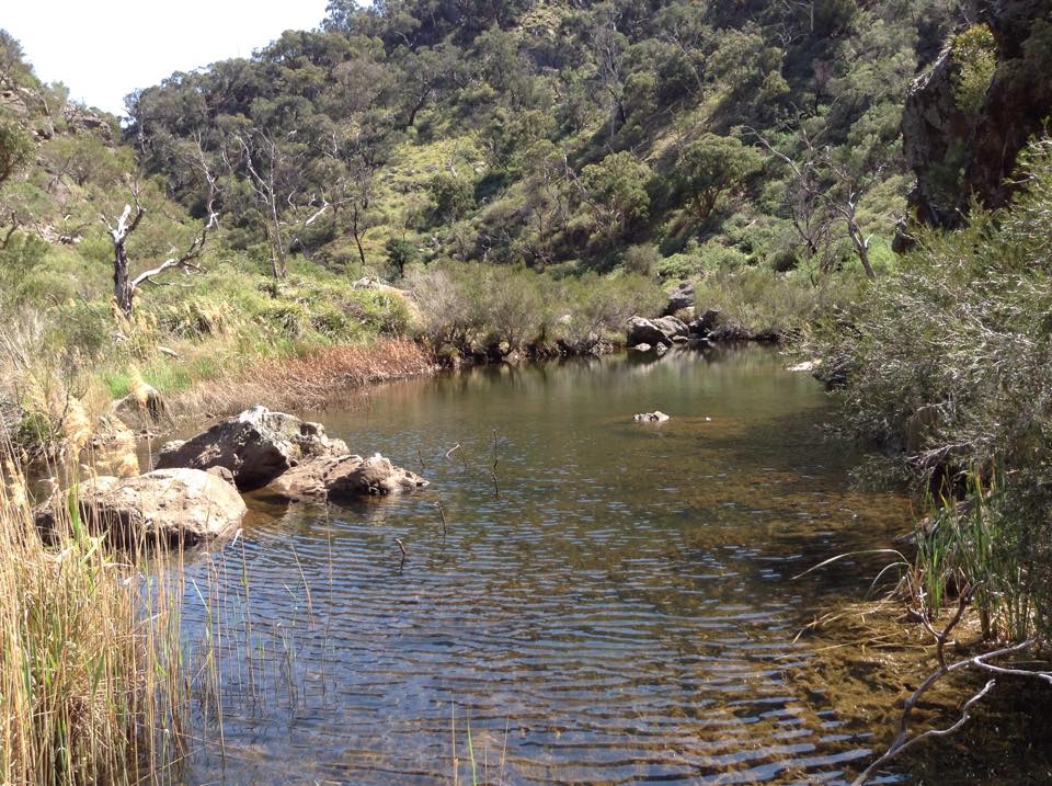
Werribee Gorge is the perfect place to spend a hot summers day outdoors: swimming at Miekle’s Point Picnic Area, rock climbing at Falcons Lookout, hiking through some of Melbourne’s most ancient rocks or… fold hunting! The geology at Werribee records almost 500 million years (Ma) of Victoria’s geological history.
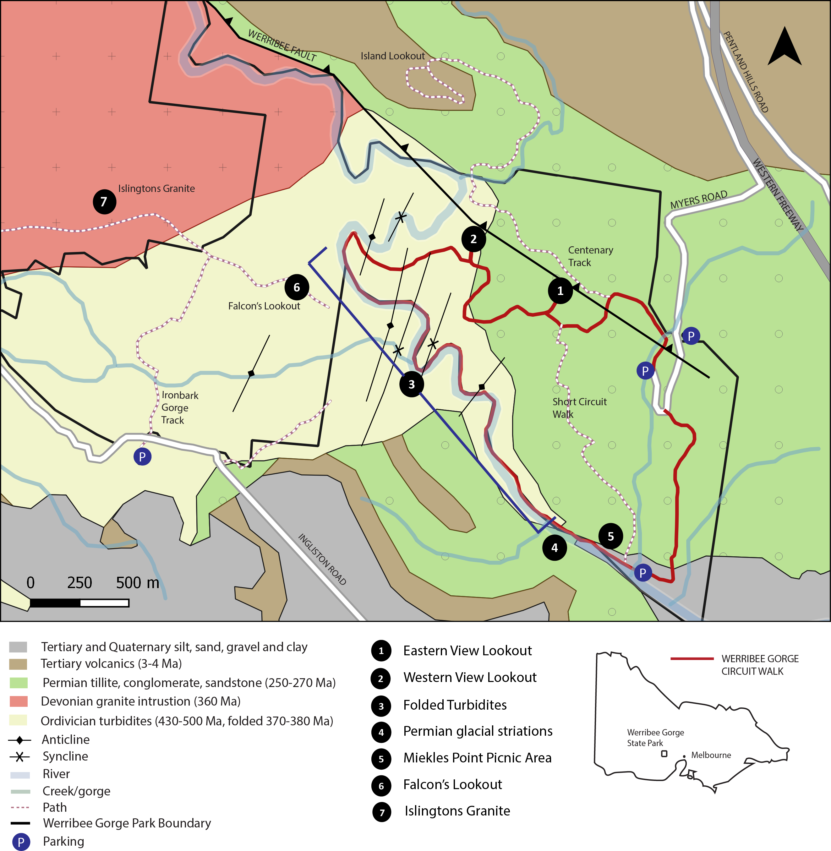
The oldest rocks in the park are the Ordovician turbidites which outcrop in the centre and south-west of the park (Point 3 in Figure 1). These sandstones and shales were deposited by avalanches (turbidites) in a deep marine setting off the eastern margin of Victoria – most of which was submerged underwater at the time (Figure 2a).
Gradually the sediments became buried and after almost 100 Ma the interbedded shales, slates, sandstones and mudstones were folded and uplifted as a result of major east-west compression (Figure 2b). You’ve seen this when you trip over a carpet corner and create ripples in the surface – folds.
This slideshow will run through the geological history of Werribee Gorge in a series of cross-sections.
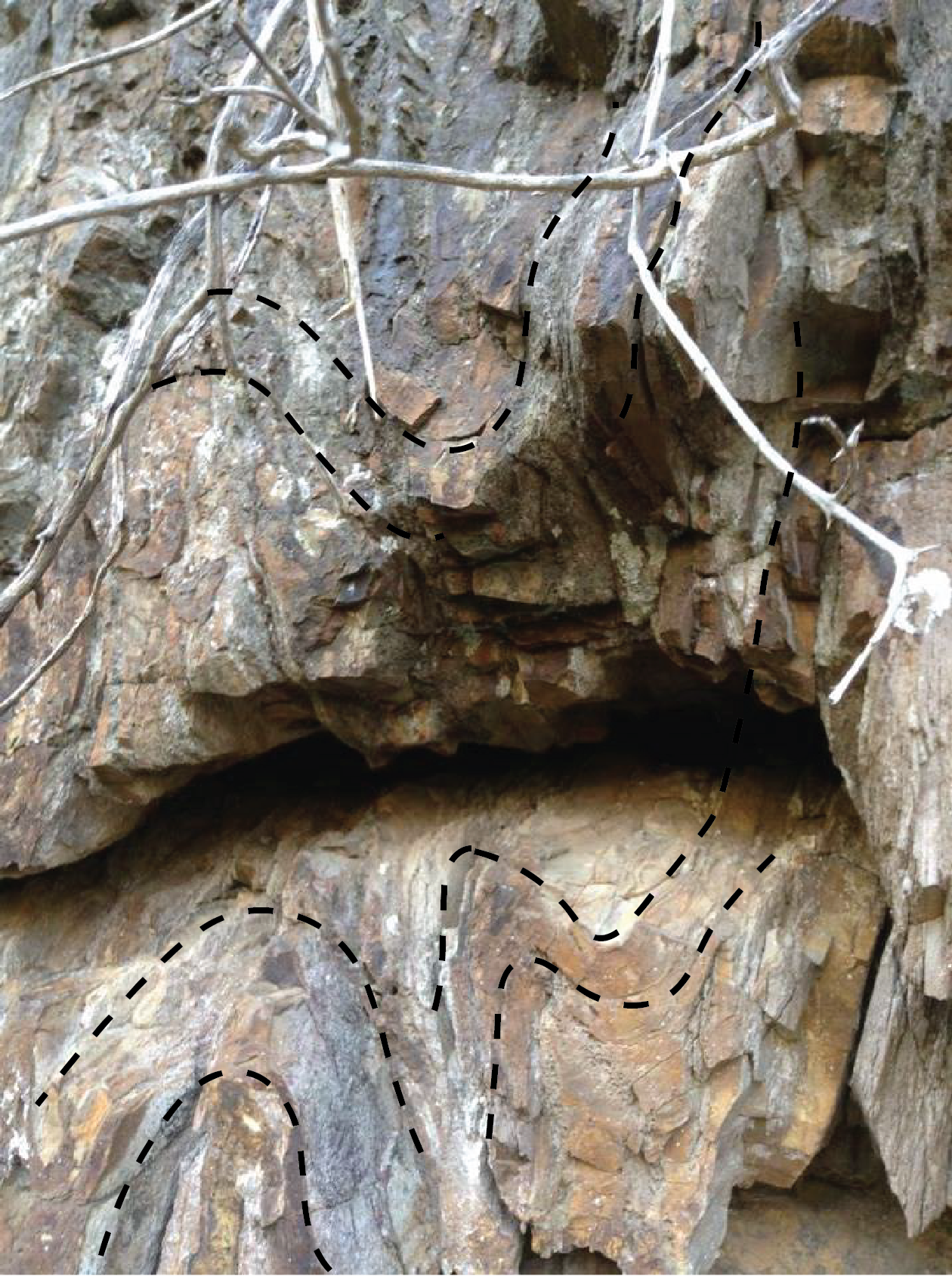
Walking along the track as you enter the creek in the stretch labelled point three (Figure 1) there are numerous examples of tight and open folds so get your geology goggles on! Folds, like most things in nature, are fractal, so a fold as big as a house probably contains a fold smaller than your finger-nail. See the images below!

From a distance it looks like a boring wall of rocks (Figure 2), but up close… a fold (Figure 3)! This is what makes the job of a geologist so hard – you have to get up close and personal with a rock to really understand it. Sometimes you have to cut the rock up and look at it under a microscope to see what’s going on.
Also keep a look out for graptolites, extinct marine creatures that formed net-like colonies which floated freely on the sea during the Cambrian and Ordovician. These fossils are what help geologists to date the rocks – they only occur during this time period, and specific types occur in even shorter time periods.
Following the period of deformation and thickening in the Early-Middle Devonian, the middle crust began to melt and magma rose up to just below the surface. The large Islington Granite intrusion (350-320 Ma) to the north-west of the park is an example of the many granites which intruded the bedrock (turbidites) during this time. It is grey and medium grained, roughly circular in outcrop and intruded by numerous dykes.
Like gum squished into the bottom of your shoe, it takes advantage of gaps – it’s stickier and runnier on a hot day (heat) and the more pressure you put on it the more it will spread!

Granite outcrops or tors (Figure 1, point 7) can be explored along the Ironbark Gorge track if you continue heading north along the fence line instead of turning off at the Falcons Lookout track (Figure 4).
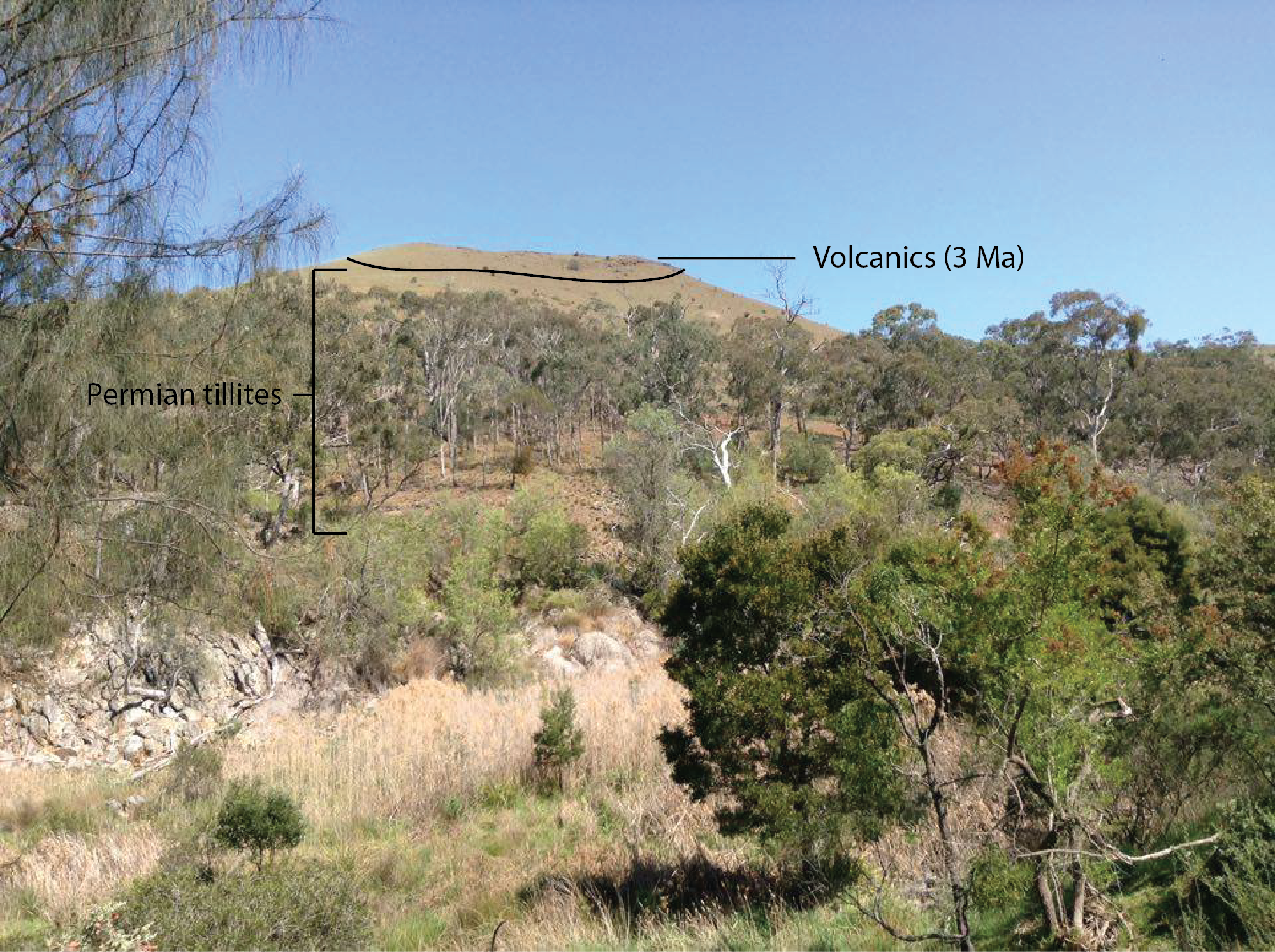
The Permian Bacchus Marsh Formation outcrops around Werribee Gorge (as well as Lake Eppalock). This formation represents the movement of a glacier from a S-SW direction across the region, with up to at least eight distinct advances (source). At this time the Australian portion of Gondwana lay near the South Pole and had a glacial climate which extended into the Triassic and Cretaceous – the time of the dinosaurs!
The Permian deposits in the Werribee Area, as well as greater Bacchus Marsh Region, is bound by east-west trending faults which form the Ballan Graben. One such east-west trending fault – Werribee Fault – can be seen in the NW of the park separating the Ordovician bedrock and granite from the Permian rocks.
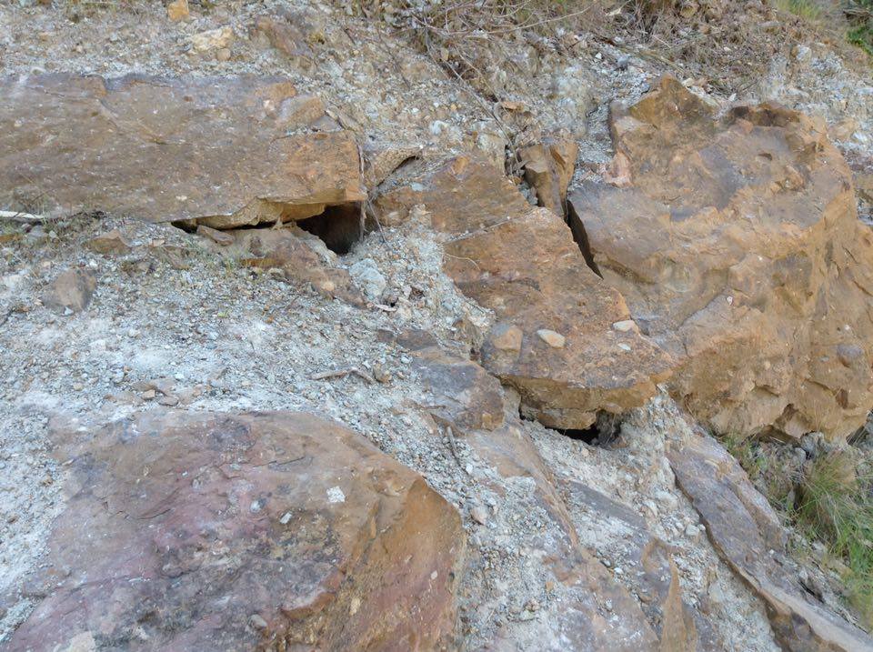
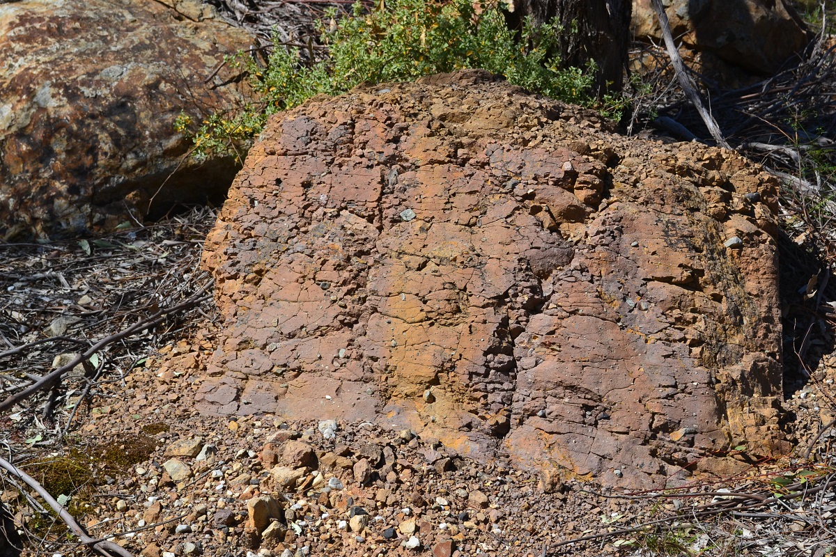
The most common Permian deposit type around Werribee Gorge is a tillite or diamictite (Figure 5), a muddy matrix mixed with pebbles of various sizes and origins (e.g. granite, sandstone, shale) collected, transported and dumped by the movement of ice sheets. The best place to see this outcrop is along the wall on the left hand side of the path at Location 4 in Figure 1, where the Permian rocks lie uncomfortably over the Ordovician turbidites.
Also keep an eye out for large slabs or pavements of sandstone with distinctive grooves in them (Figure 6). A magnificent glacial pavement can be seen at Lake Eppalock.
The other significant rocks in the area belong to the Newer Volcanics – lava flows which erupted a few million years ago from nearby volcanoes such as Mt Blackwood. The lava flows would have filled the valleys and blanketed the land. There are various signs along the walk which point out the places to see the Newer Volcanics (Figure 1).
We acknowledge the Wadawurrung and Wurundjeri Peoples as the Traditional Owners of the land upon which this field guide has been created. We recognise that many areas hold deep cultural significance for local Aboriginal groups and I hope you will keep this in mind as you explore thepark.

Leave a comment